


A slow moving upper level low pressure system will approach the area late this weekend into early next week resulting in a prolonged chance for showers and thunderstorms across North Texas. As of now the heaviest rainfall potential appears to arrive late Sunday night into Monday. Widespread rainfall amounts of 2 to 4 inches can be expected with locally heavier amounts. The greatest threat for heavy rainfall and flash flooding as of now appears to be south of Interstate 20. Stay tuned to the forecast over the next few days for further updates!
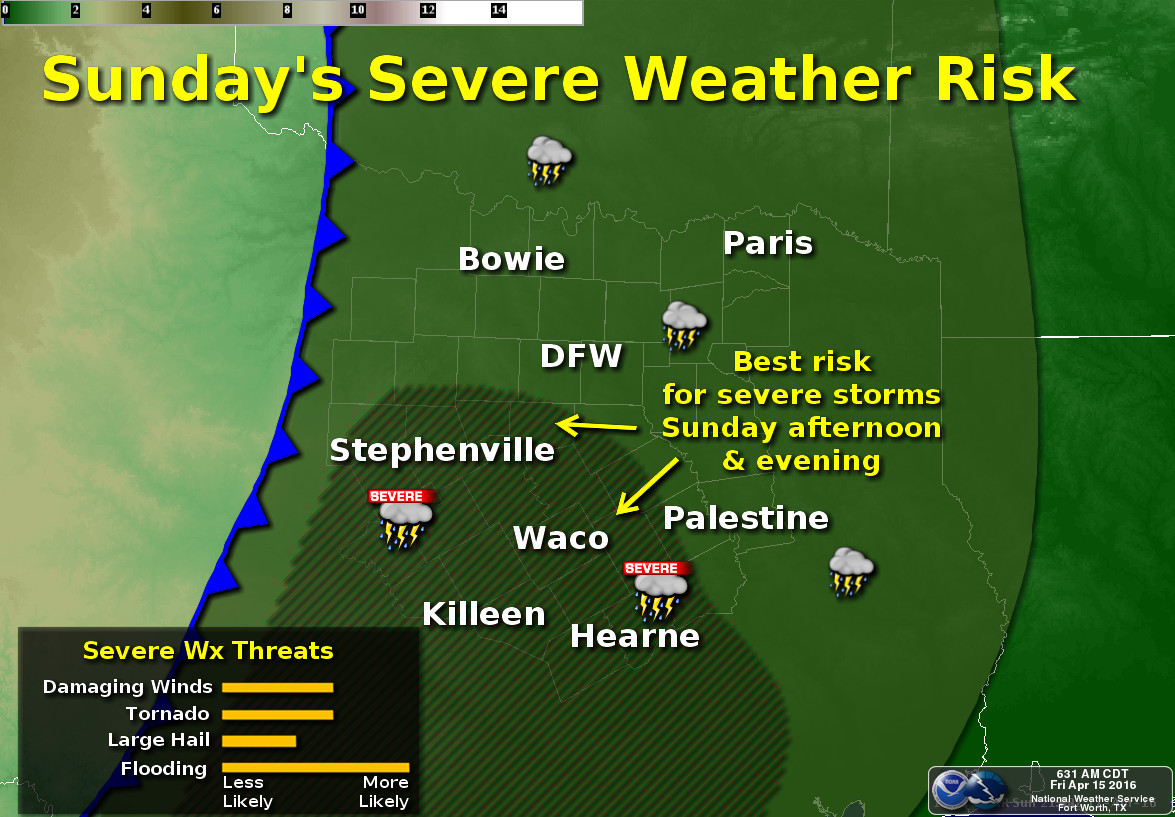
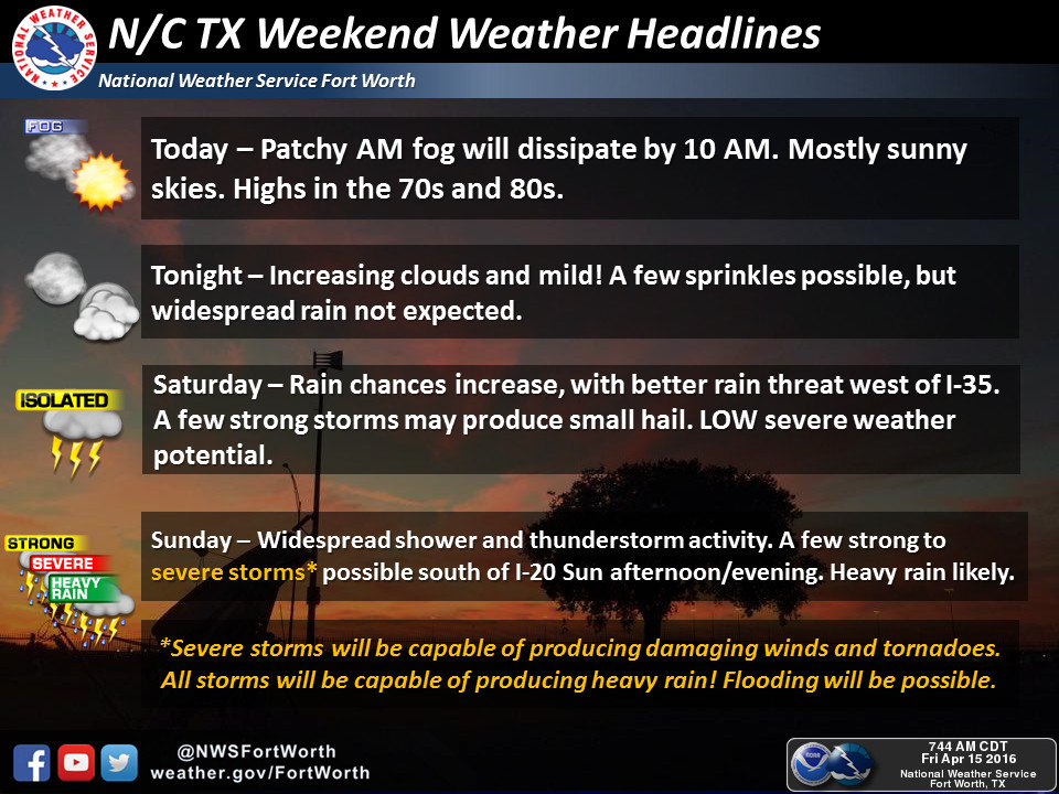
There will be a risk for severe weather on Sunday afternoon and evening as a cold front slowly inches towards the region. The main hazard will be flooding with tornadoes and damaging winds being the secondary hazard. Check back for updates to the forecast!
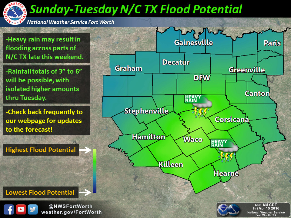
Heavy rain is expected to continue across North and Central TX towards the weekend as an upper level low approaches. Heavy rain and resultant flooding will be possible, especially across central TX. Rain totals will be on the order of 3″ to 6″. Check back frequently to our webpage for updates to the forecast!