


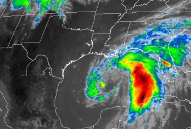
Tropical Storm Cristobal will move over the central Gulf of Mexico on Saturday, and be near the northern Gulf of Mexico coast on Sunday. There are warnings for life-threatening storm surge, tropical-storm-force winds, heavy rain, high surf/rip currents, and an enhanced risk for severe thunderstorms across parts of the northern Plains Saturday and Sunday.
Southeast Oklahoma, East Texas and Northeast Texas.
Today and Tonight
Isolated to widely scattered thunderstorms will be possible, mainly this afternoon into early this evening. A few of these storms could be on the firm side and produce gusty winds, frequent lightning, and small hail. Also, the peak heat index values will be around a little above 100 degrees. Isolated thunderstorms are possible east of I-35 this afternoon and evening. Lightning will be the main hazard.
Sunday through Friday
Cristobal, currently moving north through the southern Gulf of
Mexico should make landfall along the Louisiana coast Sunday evening as a tropical storm. A few showers and thunderstorms associated with the outermost bands of Cristobal will begin to
arrive in the region Sunday night, before increasing Monday as
the system moves inland. As it does so, some locally gusty winds
will be possible, as well as a few heavy downpours. These showers
and embedded thunderstorms will begin to diminish late Monday
night as Cristobal’s remnants lift north out of the region. Finally, the threat of isolated to widely scattered showers and thunderstorms will exist Tuesday and Tuesday night near and ahead of a weak cooling frontal passage.
SPOTTER INFORMATION STATEMENT
Not need is the activation of emergency management personnel, amateur radio operators, and storm spotters today.