


North and Central Texas
Today and Tonight
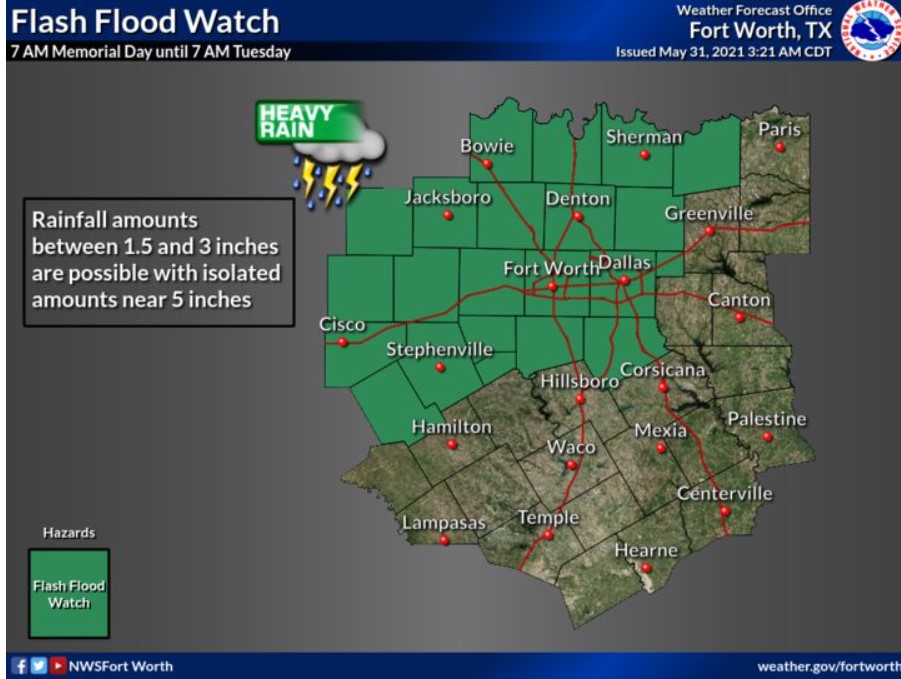
Expect widespread thunderstorms today and tonight. Heavy rain may lead to instances of flash flooding across portions of North Texas, especially tonight. In addition, strong winds along the leading edge of the storms will be possible.
Tuesday through Sunday
A few strong to marginally severe storms will be possible east of I-35 Tuesday afternoon, mainly a strong to damaging wind threat. Storm chances will continue through the rest of the week. Any heavy rain may lead to flooding.
SPOTTER INFORMATION STATEMENT
The NWS does not expect spotter activation at this time, but any reports of flooding would be greatly appreciated.
South Central and Southwest Arkansas, North Central and Northwest Louisiana, Southeast Oklahoma, East and Northeast Texas.
Today and Tonight
Showers and thunderstorms will increase in coverage across portions of southeast Oklahoma and northeast Texas tonight. Some storms may produce gusty winds and locally heavy rainfall.
Tuesday through Sunday
Showers and thunderstorms will expand areawide on Tuesday, continuing through the remainder of the workweek. Locally heavy rainfall and gusty winds may be possible with some storms on Tuesday. Some periodic serious rain concerns will likely persist into next weekend, although the risk of severe storms should generally remain low most of these days.
SPOTTER INFORMATION STATEMENT
The NWS will not need the activation of emergency management personnel, amateur radio operators, and storm spotters through this Memorial Day weekend.