


North and Central Texas
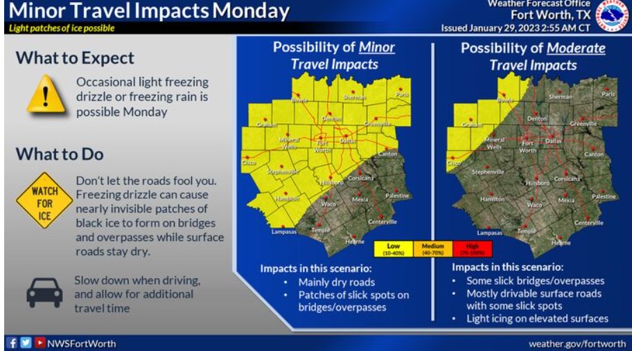
Occasional light freezing drizzle or freezing rain is possible Monday. Minor impacts are likely along and north of a line from about Lampasas to Waco to Canton. Minor effects include dry surface roads with patches of black ice on bridges and overpasses. Refrain from letting the dry surface roads fool you. Black ice is nearly impossible to see when traveling at high rates of speed. Please slow down when driving and allow additional travel time.
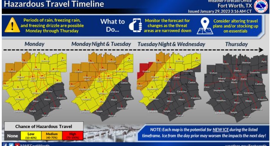
There is the potential for freezing rain and freezing drizzle next week. The highest risk of ice-related impacts should be north and west of DFW, but there is a low risk in the Metroplex. Consider altering your travel plans and stocking up on essential items if you are in the orange or red area. NOTE: These graphics display the potential for new ice accumulation during the time frames shown. If ice remains from the preceding day, impacts may worsen.
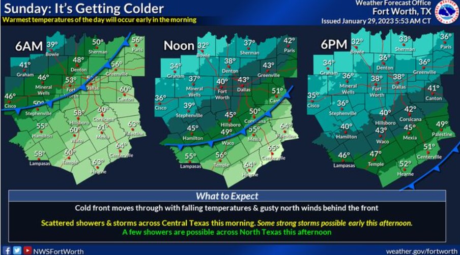
A cold front is moving through North Texas this morning and will move through Central Texas this afternoon. Expect the warmest temperatures of the day to occur in the morning, with falling temperatures behind the front. Scattered showers and storms are possible across Central Texas this morning, with some intense storms possible early this afternoon.
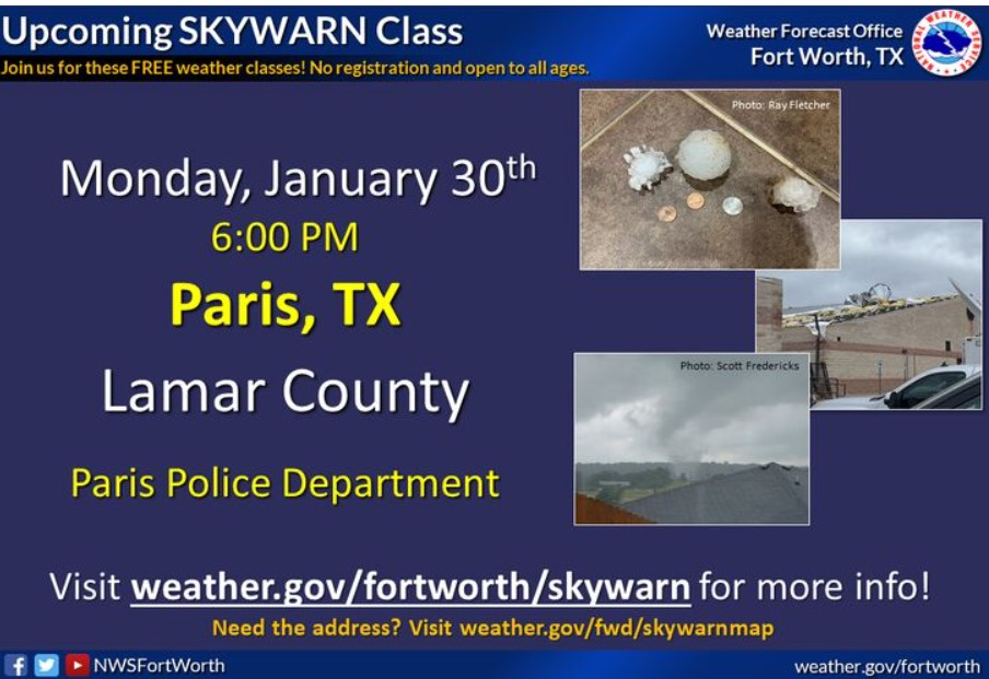
If you are interested in becoming a storm spotter, join us on Monday, January 30, for the Lamar County SKYWARN class! This class will be at the Paris Police Department. The course starts at 6:00 pm and is free and open to anyone who would like to attend. If you can’t make this class, feel free to join any other classes we will offer this SKYWARN season. You can find the full schedule and additional details by visiting weather.gov/fwd/skywarnmap!
Today and Tonight
Scattered thunderstorms will be possible this morning and early this afternoon across Central Texas. A few intense storms may be capable
of small hail and gusty winds.
Monday through Saturday
Freezing rain is expected Monday through Wednesday, mainly north and west of the Dallas/Fort Worth Metroplex. Ice accumulation
will impact travel.
SPOTTER INFORMATION STATEMENT
Do not expect spotter activation at this time.
South Central and Southwest Arkansas, North Central and Northwest Louisiana, Southeast Oklahoma, and East and Northeast Texas
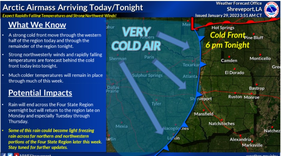
Colder, arctic air will arrive tonight across the entire Four State Region. Unfortunately, the cold air will be here to stay through much of the upcoming work week.
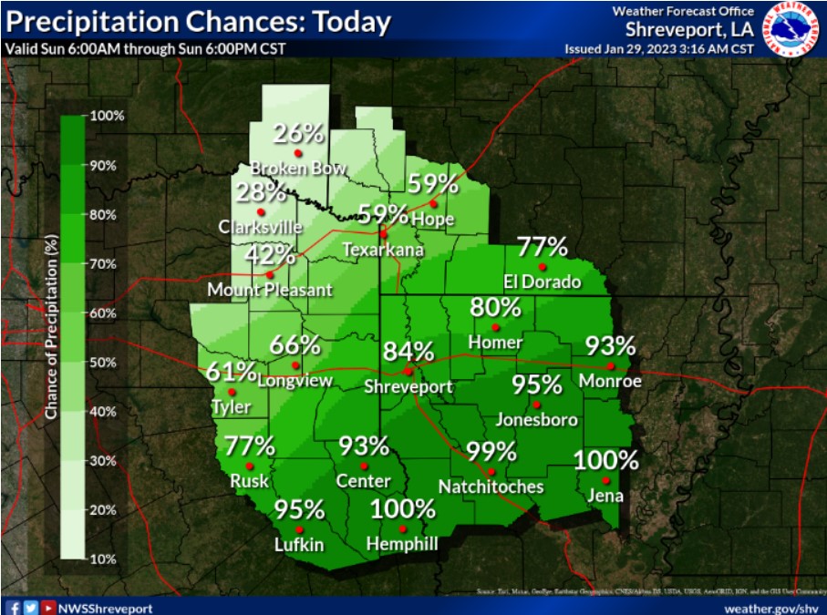
Scattered to numerous showers and thunderstorms will be possible today in advance of a strong cold front. Today’s most significant rain chances will be near and south of the I-20 Corridor.
Showers and isolated thunderstorms will be possible south of the Interstate 30 corridor today as a disturbance and cold front move across the region. Expect no widespread severe weather, although an isolated strong to severe thunderstorm will be possible south of the Interstate 20 corridor in East Texas and Louisiana this afternoon. The primary threat would be damaging winds and large hail. After the frontal passage, much cooler and drier air will move into the region tonight.
Monday through Saturday
Look for increasing rain chances once again late in the day Monday with those rain chances remaining high through at least Thursday
across most of the Four State Region. After several days of widespread rainfall will result in several inches of rain during much of next
week across the Four State Region. It will result in additional rises on area lakes and rivers, along with the possibility of flooding of low-lying and poor drainage areas. In addition to the flooding threat next week, there will be a threat of light freezing rain across far northern portions of Northeast Texas, Southeast Oklahoma and Southwest Arkansas, mainly during the overnight periods Monday through Wednesday.
SPOTTER INFORMATION STATEMENT
Do not expect spotter activation at this time.