


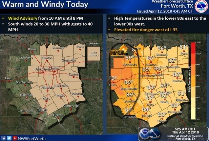
This Hazardous Weather Outlook is for portions of South Central
Arkansas, Southwest Arkansas, North Central Louisiana, Northwest
Louisiana, Southeast Oklahoma, East Texas, Northeast Texas, and North Texas.
A Lake Wind Advisory is in effect for extreme Northwest Louisiana, Southern Arkansas, East and Northeast Texas and Southeast Oklahoma through this afternoon. Boaters on area lakes should exercise caution.
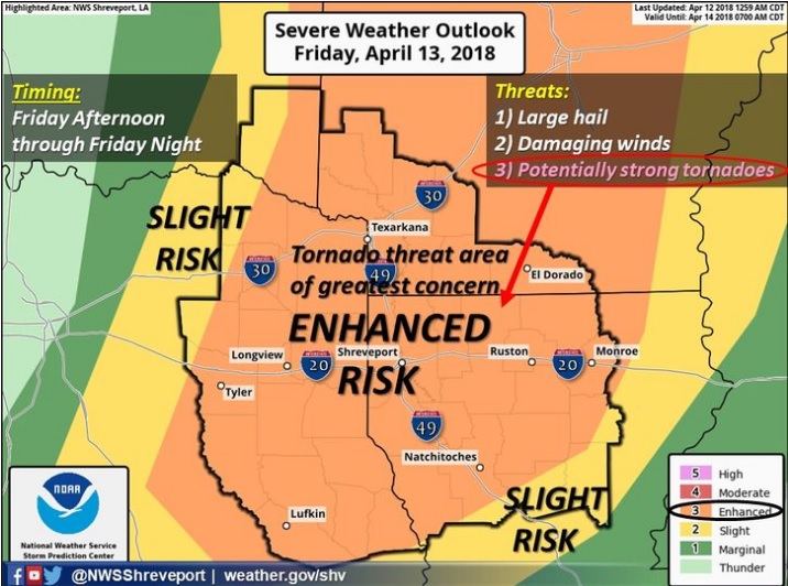
Severe thunderstorms will be possible on Friday afternoon into Friday night and possibly linger into Saturday morning. Expect large hail, damaging winds, isolated tornadoes, and locally heavy rainfall on Friday afternoon with organized thunderstorms. Severe potential will shift into more of a heavy rain, and damaging wind threat as storms evolve into a squall line Friday evening ahead of a cold front which will be arriving late Friday night through early Saturday morning. The severe threat should be ending before daybreak on Saturday with the cold front gradually clearing the region later in the morning. Rainfall totals of as high as four inches may be possible across portions of North-Central Louisiana and South-Central Arkansas.
Not need through Thursday night is the activation of emergency management personnel, amateur radio operators, and storm spotters. Expect activation by Friday afternoon, through much of Friday night.