


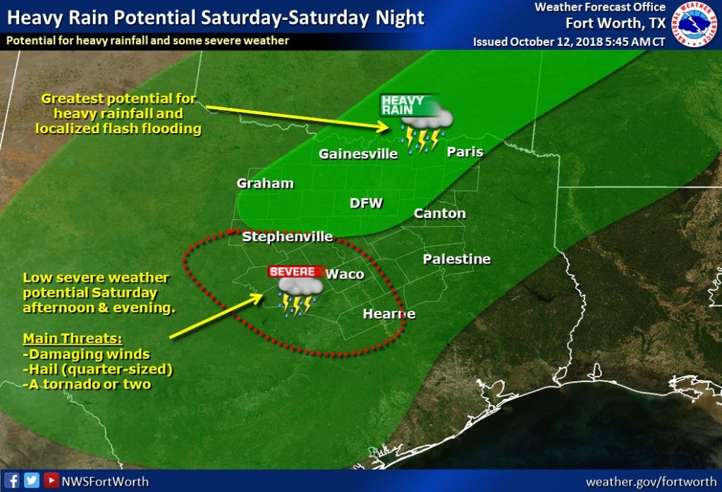
Widespread showers and storms are expected on Saturday as the remnants of currently Tropical Storm Sergio interact with copious moisture across North and Central Texas. There is a threat for heavy rainfall, mainly along and north of I-20/30 on Saturday and Saturday night, and this could lead to some flash flooding. In addition, there is a low severe weather threat mainly south of I-20 and west of I-45. The main threats will be a few damaging wind gusts and quarter-sized hail,but a tornado or two cannot be ruled out.
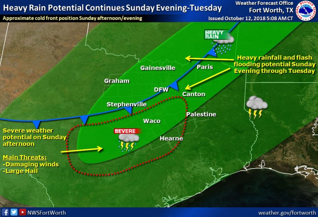
The heavy rainfall potential will continue on Sunday evening through Tuesday behind a powerful cold front. There is also a low severe weather potential on Sunday ahead of the front across parts of Central Texas. The main threats will be from a few damaging wind gusts and large hail, but activity will tend to diminish as it is undercut by the front. Heavy rainfall may lead to flash flooding across much of North and Central Texas during this time frame.