


North and Central Texas
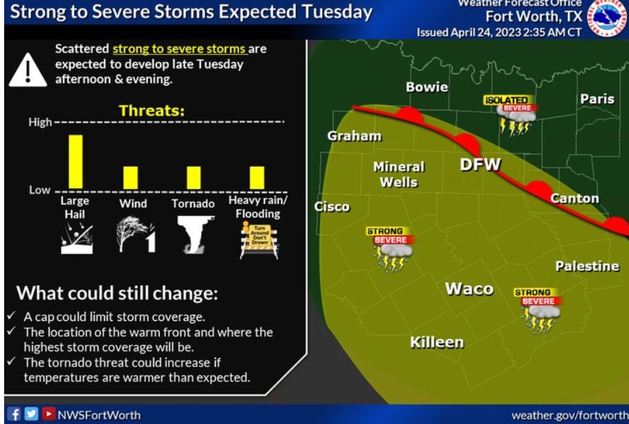
A solid upper-level impulse will approach from the northwest, helping to draw a warm surface front northward. Though the day will start very cool in the 50s and showery, afternoon temperatures will warm into the 60s and 70s in the wake of the warm front, as lift increases later in the day into Tuesday night with gusty southeast winds 15-20 mph. Instability will be on the increase with the increasing threat of large hail. Localized damaging winds may also pose a danger late for areas mainly south of the I-20/30 corridors. Continue to monitor future revised forecasts regarding the possible severe weather on Tuesday.
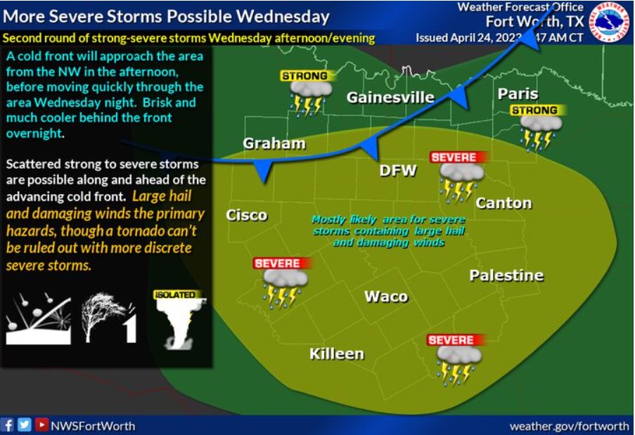
A strong cold front will arrive Wednesday evening, with showers and thunderstorms ending from northwest to southeast through midnight. The airmass will be warm and unstable as the front and upper system move through, with strong to severe storms possible, especially along and south of Interstates 20 and 30. Large hail and damaging winds are the primary hazards, though more discrete storms can create an isolated tornado. Highs in the 60s Red River will warm into the 70s to near 80 in Central Texas—brisk and much more relaxed behind the cold front by Thursday morning.
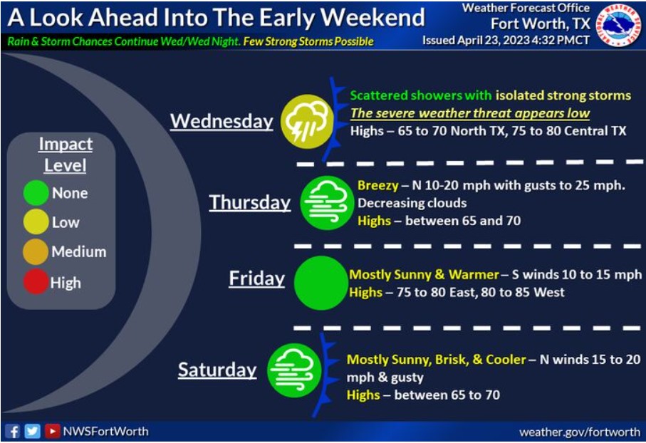
Showers with scattered thunderstorms will continue Wednesday and Wednesday night as the primary upper disturbance passes east across the region. A few intense storms may occur before the next cold front arrives late Wednesday and Wednesday evening. Rain ends from west to east on Thursday with brisk and cooler temperatures. South winds and warmer temperatures return Friday before another cold front Friday night/early Saturday cools things off again. Primarily dry weather is expected Thursday through Saturday.
South Central and Southwest Arkansas, North Central and Northwest Louisiana, Southeast Oklahoma, and East and Northeast Texas
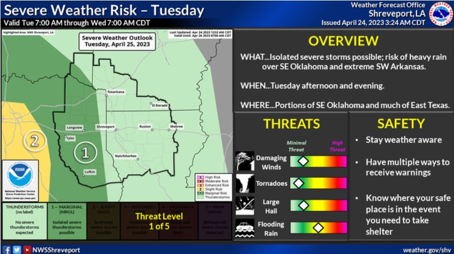
There is a risk for severe weather on Tuesday across portions of Southeast Oklahoma and much of East Texas. Damaging winds and large hail will be the primary threats. In addition, locally heavy rainfall could result in isolated flash flooding, especially across Southeast Oklahoma and adjacent portions of Southwest Arkansas.
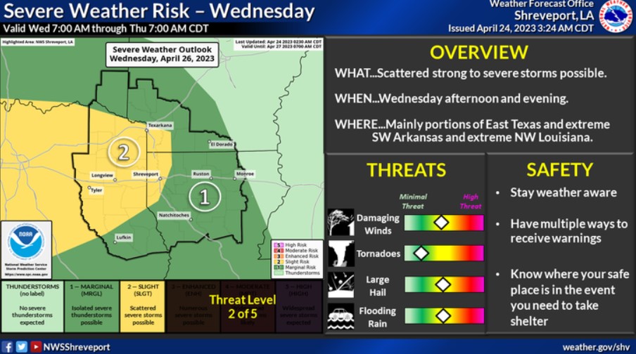
There is a risk for severe weather across the entire Four State Region Wednesday afternoon and evening. The most significant risk will be across much of East Texas and portions of extreme Southwest Arkansas and Northwest Louisiana. Damaging winds and large hail will be the primary threats. In addition, locally heavy rainfall will be possible.