


North and Central Texas
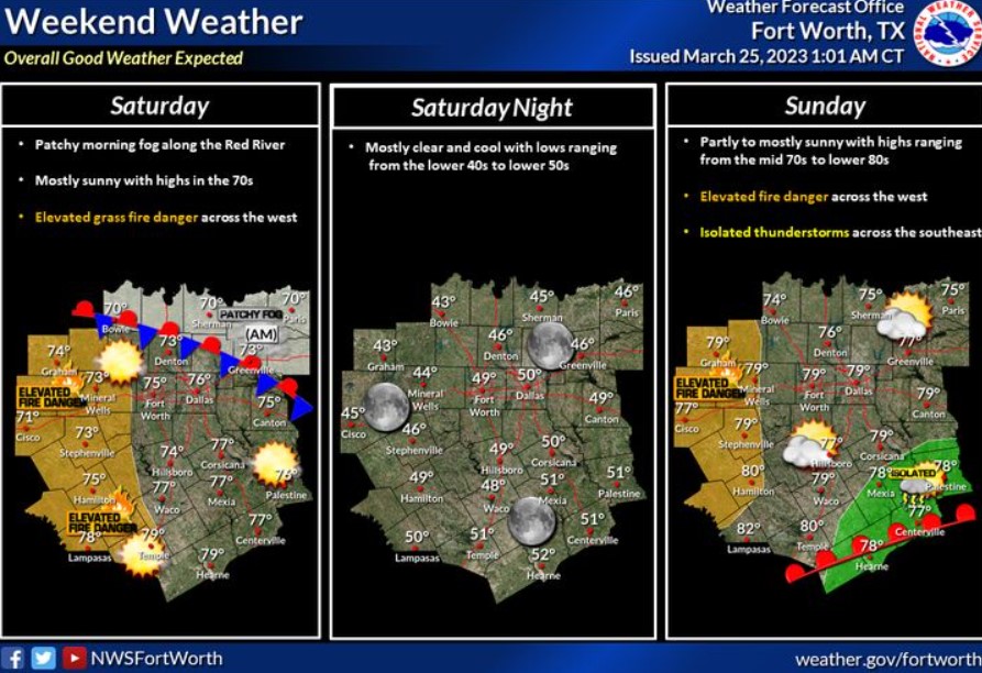
Patchy morning fog will give way to mainly sunny conditions with highs in the 70s this afternoon. Unfortunately, dry and breezy weather will create high-fire weather conditions across the western counties during Saturday and Sunday afternoons. Isolated storms will be possible across the southeast on Sunday, but the NWS does not expect severe weather. Night-time lows will be near average, in the lower 40s to lower 50s, under mostly clear skies.
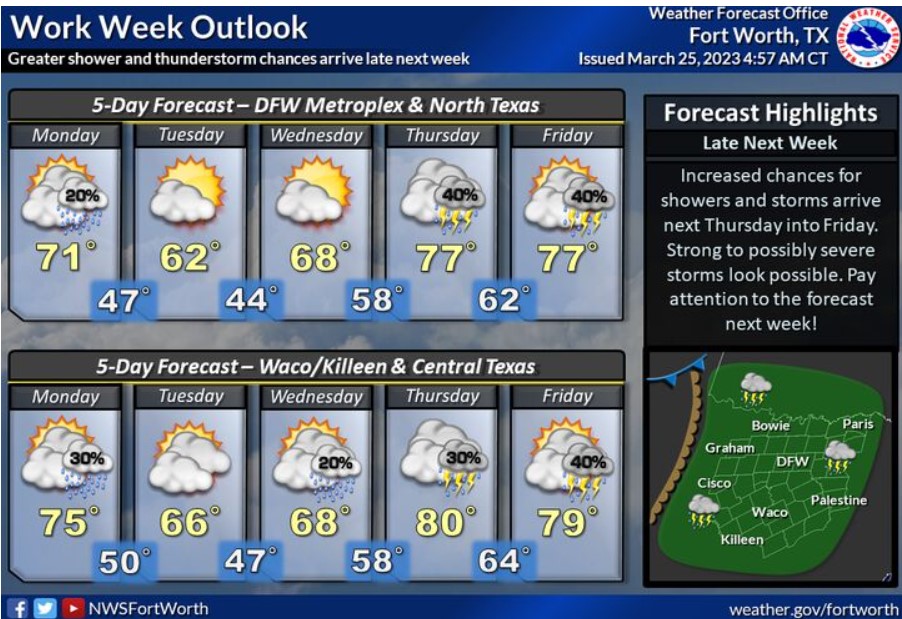
Low chances for showers and possibly a few thunderstorms will exist on Monday as a frontal boundary stall across Central Texas. A push of cooler air arrives on Tuesday, knocking high temperatures into the low to mid-60s. Showers and thunderstorm chances come late next week as an upper-level disturbance approaches the region. Strong to severe storms look possible, so pay attention to the forecast next week!
South Central and Southwest Arkansas, North Central and Northwest Louisiana, Southeast Oklahoma, and East and Northeast Texas
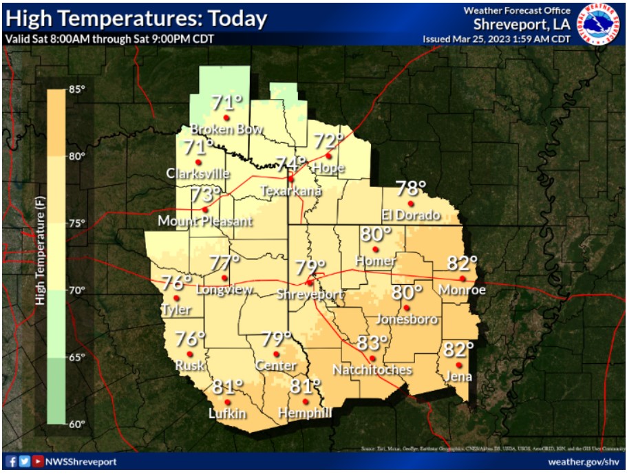
Under sunny skies, temperatures this afternoon will climb into the lower 70s northwest to lower 80s south and east.
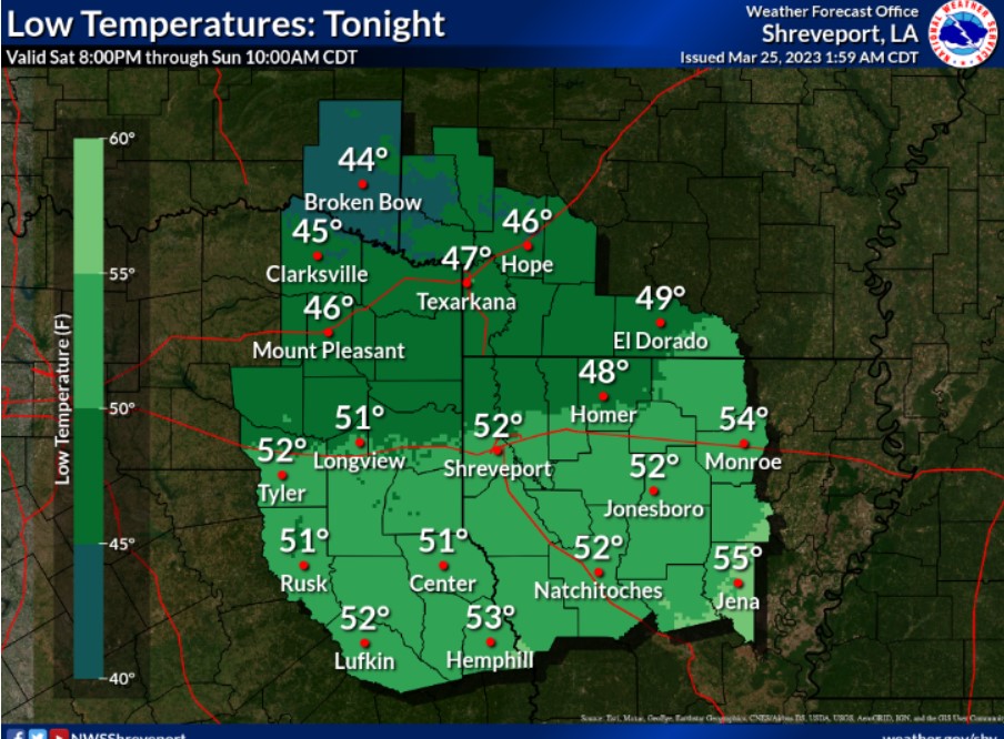
Skies will remain mostly clear overnight as lows drop into the mid-40s north to lower 50s south.
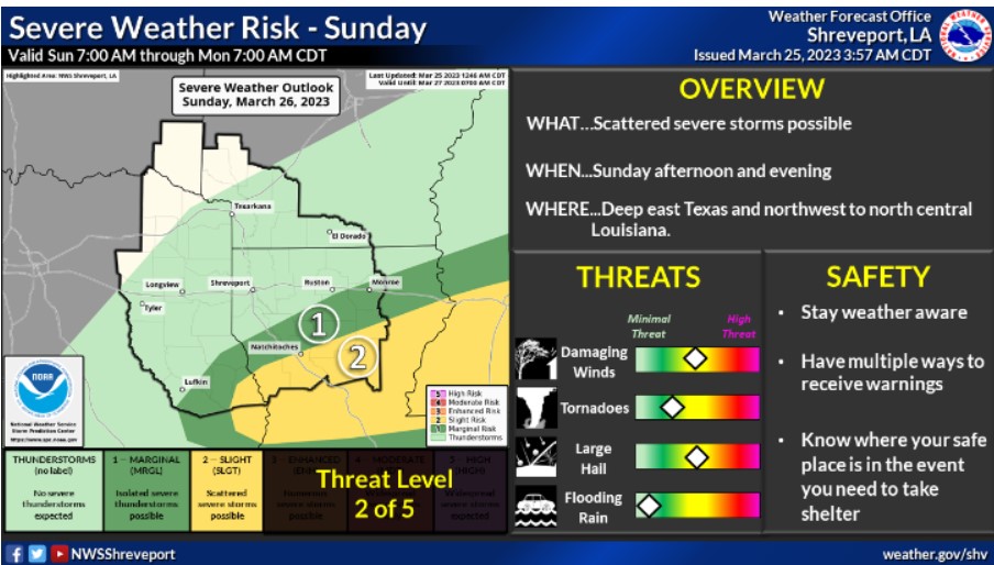
Severe weather will again be possible Sunday afternoon and evening across the southernmost zones of the ArkLaTex. The primary threats look to be damaging winds and large hail.