


North and Central Texas
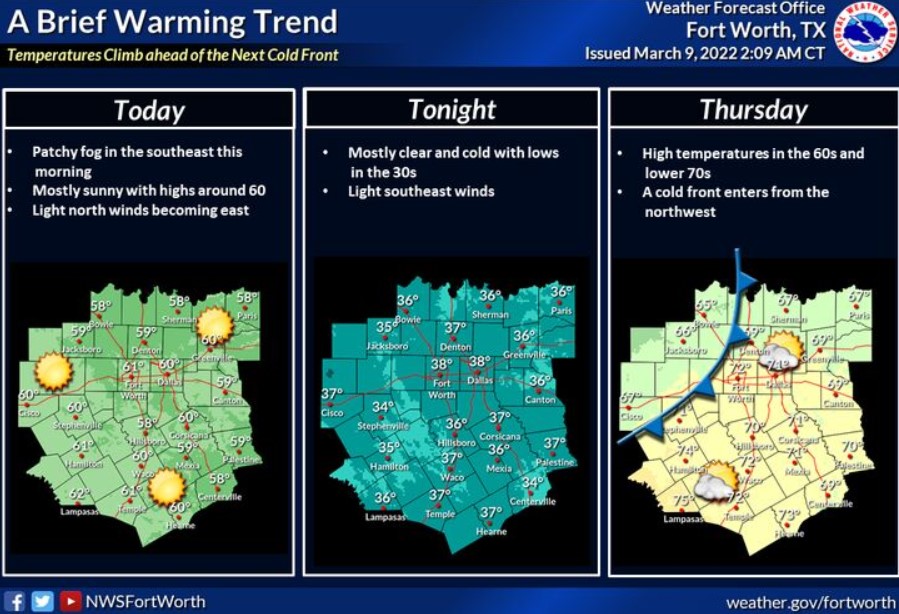
After a bitter Wednesday morning, expect warmer weather ahead of the next cold front. Highs today will be around 60, then closer to 70 on Thursday. The cold front will enter from the northwest Thursday afternoon. On Friday, temperatures will be cold enough for wintry precipitation across North and Central Texas. Accumulations of snow and sleet may occur mainly in the blue-shaded areas and expect cold rain elsewhere. Precipitation will end from west to east Friday afternoon. However, there are uncertainties in the forecast, so continue to monitor for updates this week as we refine the details.

South Central and Southwest Arkansas, North Central and Northwest Louisiana, Southeast Oklahoma, and East and Northeast Texas
Today and Tonight
Showers and isolated thunderstorms will increase in coverage today into this evening, with the highest chances mainly south of Interstate 30. The forecast does not expect severe weather, but locally, heavy rainfall may be possible at times.
Wednesday through Monday
By early Friday, a strong cold front will bring another chance of showers to the region and may support a brief period of wintry mix across portions of Southeast Oklahoma on Friday morning. Conditions forecast to improve through the early evening hours of Friday.
SPOTTER INFORMATION STATEMENT
The NWS will not need to activate emergency management personnel, amateur radio operators, and storm spotters.