


North and Central Texas
Today and Tonight
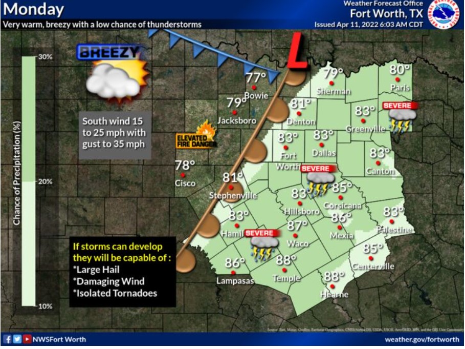
Afternoon storms are possible today and this evening with some severe storms possible. However, expect coverage to be minimal. Large hail and damaging wind will be the primary hazards, but an isolated tornado is also possible.
Tuesday through Sunday
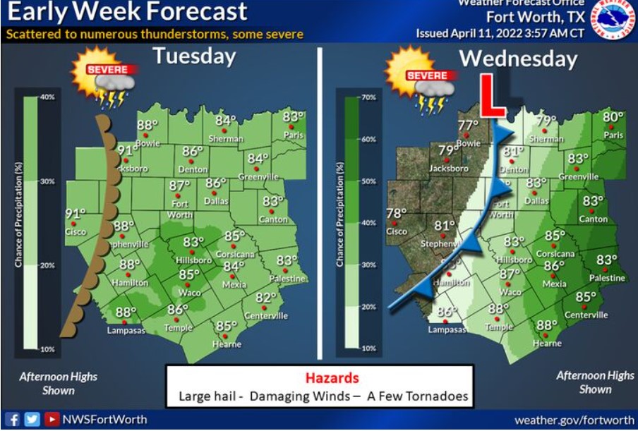
Tuesday through Wednesday will be unsettled across North and Central Texas, scattered with numerous showers and thunderstorms. Some storms may be severe with large hail, damaging winds, and a few tornadoes. Storm chances will end from west to east Wednesday with the passage of a cold front. Highs Tuesday will be mainly in the 80s, except for some lower 90s in the west. Highs on Wednesday will range from the upper 70s in the west to the upper 80s in the south.
An elevated fire threat will continue west of US-281 each afternoon Tuesday through Friday, with the most significant hazard on Wednesday. Thunderstorm chances continue Tuesday and Wednesday, with some severe storms possible. Hail, damaging winds, and a few tornadoes will be possible, especially on Tuesday afternoon and evening. There is a slight chance of thunderstorms east of the I-35 corridor Friday afternoon and Sunday.
SPOTTER INFORMATION STATEMENT
Minimal spotter activation is possible across North and Central Texas this afternoon and evening.
South Central and Southwest Arkansas, North Central and Northwest Louisiana, Southeast Oklahoma, and East and Northeast Texas
Today and Tonight
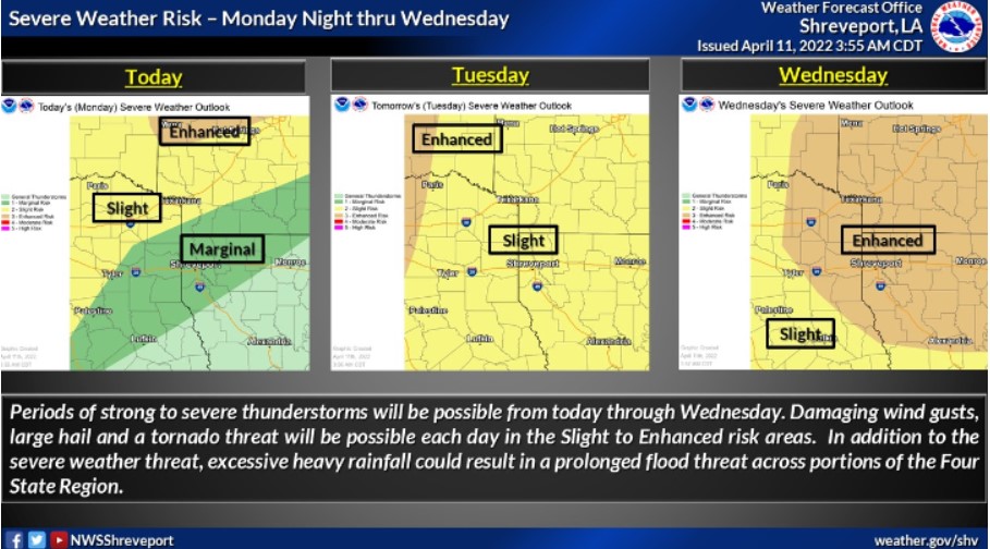
Chances for showers and thunderstorms will return to the area this evening. Some storms may be severe, especially across areas north of the Interstate 30 corridor. Large hail will be the primary threat, but locally damaging wind gusts and an isolated tornado will also be possible. Also, a Wind Advisory is in effect through 3:00 pm today for Northern Louisiana and most of East Texas. Look for high southerly winds with sustained wind speeds around 20 to 30 mph and gusts upwards of 40 mph.
Tuesday through Sunday
Chances for thunderstorms will remain across the area on Tuesday and Wednesday. Multiple rounds of thunderstorms are likely these days. Some of these storms may be severe, with all modes of severe weather possible. Heavy rainfall will also be possible on Tuesday and Wednesday, which could lead to localized flooding.
SPOTTER INFORMATION STATEMENT
The NWS will need to activate emergency management personnel, amateur radio operators, and storm spotters through Wednesday.