


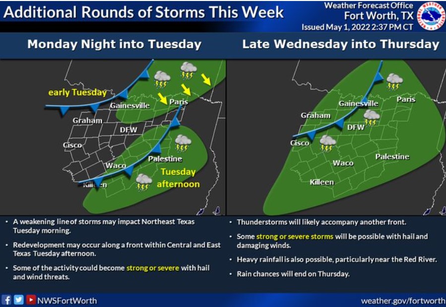
North and Central Texas
Today and Tonight.
Thunderstorms will continue this morning, mainly northeast of the
Metroplex where locally heavy rainfall and frequent lightning may
occur. The strongest storms could produce some severe hail and gusty
winds.
This afternoon, there is a low chance for storms, mainly along a
dryline west of I-35. However, any storms that develop could be severe.
Tuesday through Sunday
There will be a chance of thunderstorms on Tuesday, primarily across Central and East Texas. Expect one final round of storms Wednesday into Thursday. Severe weather may accompany the activity and the potential for heavy rainfall.
SPOTTER INFORMATION STATEMENT
The NWS does not expect the activation of spotters at this time.
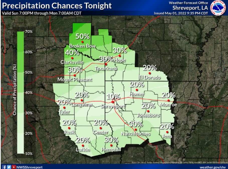
South Central and Southwest Arkansas, North Central and Northwest Louisiana, Southeast Oklahoma, and East and Northeast Texas
Monday through Saturday
Scattered thunderstorms will be possible Monday over portions of
Northeast Texas, Southeast Oklahoma, Southwest Arkansas, and
Northwest Louisiana, as an upper-level disturbance, ejects northeast through these areas. An approaching frontal system will result in another increase in thunderstorms over the region Tuesday. Isolated intense storms can not be ruled out Monday and Tuesday, with hail and locally gusty winds the main threats.
Thunderstorms will increase once again late Wednesday and into Thursday ahead of another cold front, which will yield the potential for severe thunderstorms over the region.
SPOTTER INFORMATION STATEMENT
Do not anticipate the activation of emergency management personnel, amateur radio operators, and storm spotters through tonight.