


North and Central Texas
Today and Tonight.
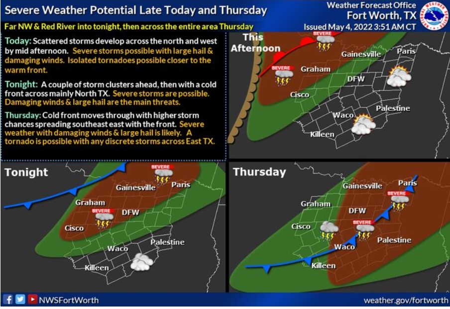
Storm chances and the potential for severe weather return to parts of North Texas through tonight then spreads into Central and East Texas Thursday with the passage of a cold front. The primary hazards will be large hail, damaging winds, frequent lightning, and locally heavy rainfall. A tornado is a possible tonight closer to a warm front and Northwest Texas into the Red River, then with any discrete storms east of I-35 on Thursday.
Expect thunderstorms to increase in coverage later this afternoon and especially tonight, mainly north of I-20 and west of I-35. Severe weather will be possible, including the threat of damaging winds and large hail. It is also possible for a tornado or two, mainly north of I-20. Locally heavy rainfall may also cause flooding issues near the Red River.
Thursday through Tuesday
Thunderstorms will continue to move south and east across the region on Thursday as a cold front move through. Severe weather will be possible along this line of storms, with damaging winds being the main threat.
Isolated thunderstorms may develop along a dryline Monday and Tuesday west of I-35. Any storms developing could be severe.
SPOTTER INFORMATION STATEMENT
Do not expect activation of spotters at this time.
South Central and Southwest Arkansas, North Central and Northwest Louisiana, Southeast Oklahoma, and East and Northeast Texas
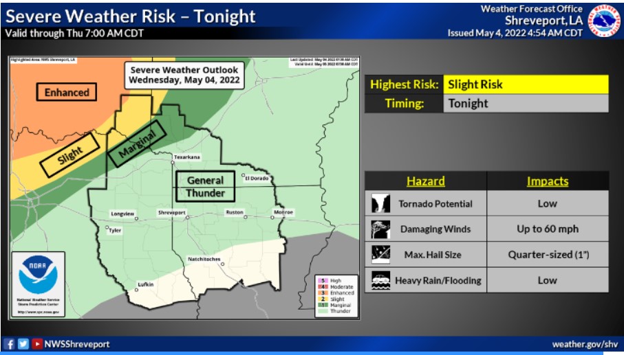
There is a Slight Risk for severe thunderstorms tonight for portions of extreme Northeast TX, Southeast OK, and adjacent sections of Western AR. Damaging winds, hail, and locally heavy rainfall, which may lead to minor flooding, will be possible in stronger storms.