


North and Central Texas
Today and Tonight.
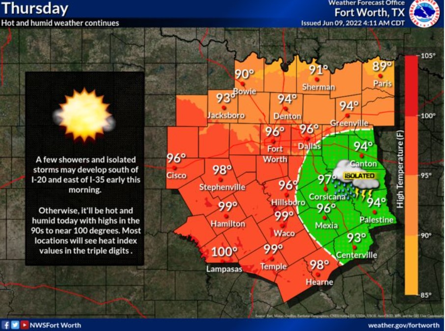
There is a slight chance of thunderstorms south of I-20 and east of I-35 this morning. Lightning will be the main threat. Additional low
storm chances are expected tonight north of a Sherman to Sulphur Springs line. The NWS does not expect severe weather.
Friday through Wednesday
Abnormally hot temperatures are expected Friday through Tuesday. High temperatures will range from the mid-90s to around 106. As a result, heat index values will be in the upper 90s to about 110 degrees.
SPOTTER INFORMATION STATEMENT
The NWS does not expect spotter activation at this time.
South Central and Southwest Arkansas, North Central and Northwest Louisiana, Southeast Oklahoma, and East and Northeast Texas
Today and tonight
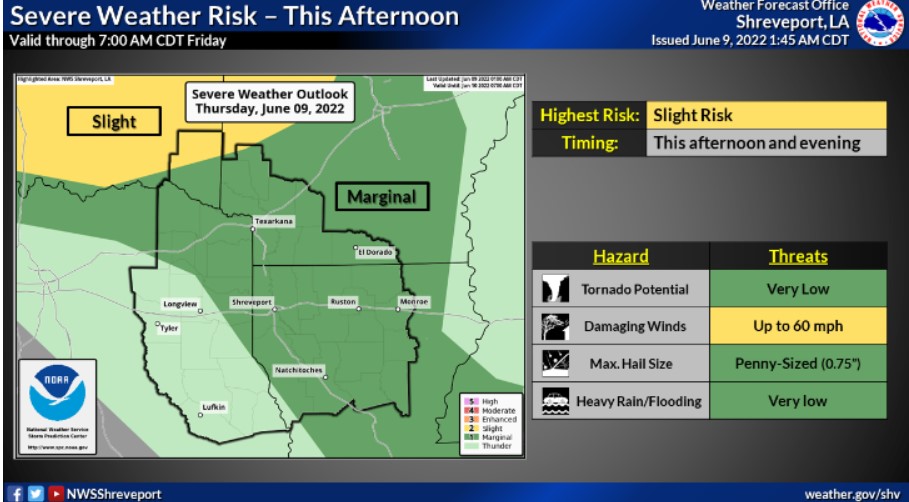
Scattered thunderstorms will be possible this afternoon and overnight with an approaching weak cold front. Some of these storms may be strong to severe, with damaging winds and hail being the primary threats.
Friday through Wednesday
Expect additional thunderstorm chances to expand into Friday and Friday night. Strong to severe thunderstorms can not be ruled out, with damaging winds remaining the primary threat. Rain chances diminish across our four-state area this weekend as the upper-level ridge builds.
SPOTTER INFORMATION STATEMENT
The NWS will not need to activate emergency management personnel, amateur radio operators, or storm spotters tonight.