


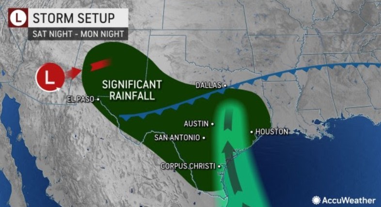
The forecast indicates 1-3 inches of rain from central New Mexico to the central Texas coast. However, within this zone, double that amount of rain is likely. The rainfall will help boost water levels in some reservoirs and rivers that have been dwindling. Too much of a good thing is possible as well.
Two weather systems will work together to produce a large area of soaking rain and raise the risk of flash flooding in portions of the south-central United States that need rainfall following months of drought.
The storm that produced spotty thundershowers in Southern California on Tuesday and the same cold front responsible for creating severe weather in the Midwest will join forces over portions of the southern Rockies and Plains for several days spanning from Sunday to at least next Tuesday.
Parts of Texas and New Mexico could receive upwards of six inches of rain in the coming days.
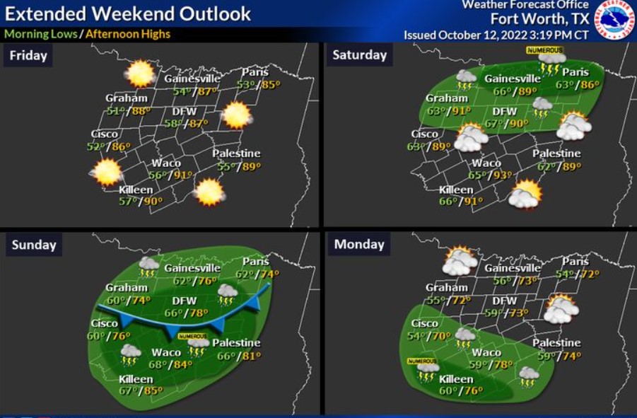
North Texas will kick off the weekend Friday with highs in the upper 80s and low 90s and mostly sunny skies. However, clouds will begin to build into Saturday, with rain chances increasing for North Texas by Saturday evening. The best opportunity for rain chances will be on Sunday as a cold front moves through the region. Noticeably cooler temperatures will follow on Monday, with highs in the low 70s and lows in the upper 50s.