


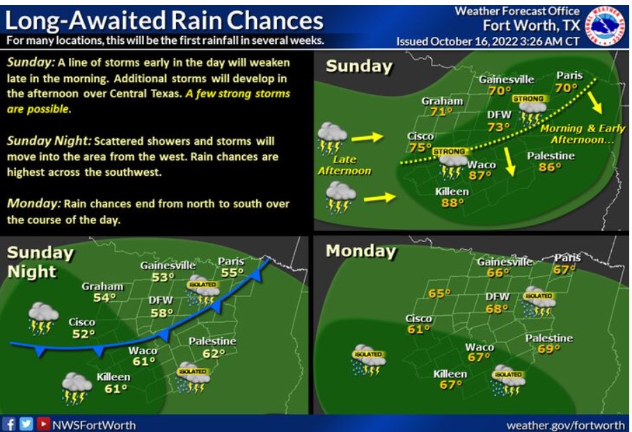
North and Central Texas
Sunday and Sunday Night
A line of thunderstorms will pass through North Texas this morning and weaken early this afternoon. Additional scattered showers and storms will develop this afternoon, with off-and-on rain continuing tonight into Monday. Rain chances will end from north to south Monday. A few intense storms are possible Sunday. Rainfall amounts should range from 0.5″ to 1″, with locally higher amounts.
Monday through Friday
Widespread rainfall and embedded thunderstorms will continue through Monday afternoon and end from north to south. A few storms could contain gusty winds and small hail.
SPOTTER INFORMATION STATEMENT
The NWS does not expect spotter activation at this time.
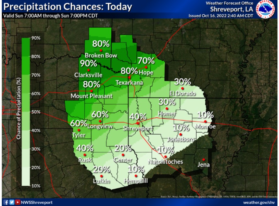
South Central and Southwest Arkansas, North Central and Northwest Louisiana, Southeast Oklahoma, and East and Northeast Texas
Sunday and Sunday Night
Scattered showers and thunderstorms will impact portions of the Four-State Region today. Today’s most excellent thunderstorm chances will be across the western half of the region, especially across Southeast Oklahoma, parts of adjacent Arkansas, and far and extreme Northwest Louisiana. Strong wind gusts near 30 mph, along with frequent cloud-to-ground lighting, may accompany these storms.
Monday through Saturday
The NWS expects no hazardous weather at this time.
SPOTTER INFORMATION STATEMENT
The NWS does not expect spotter activation at this time.