


North and Central Texas
Wednesday and Wednesday night
Dense fog may occasionally reduce visibility to a quarter of a mile or less across Central Texas this morning.
Thursday through Tuesday
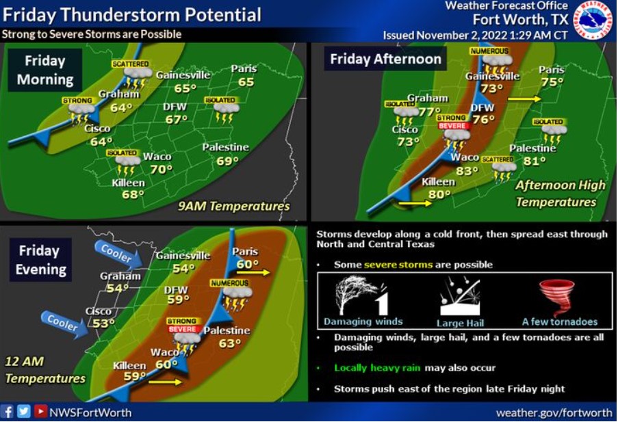
There is a slight chance of storms Thursday night. Scattered to numerous thunderstorms are expected on Friday, mainly in the afternoon and evening. Some could become severe with large hail, damaging winds, and a few tornadoes. Locally heavy rain will also be possible.
SPOTTER INFORMATION STATEMENT
The NWS does not expect spotter activation at this time.
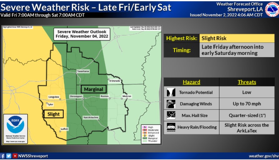
The Storm Prediction Center’s three-day outlook has a Slight Risk for many of our Texas and Oklahoma counties mid to late Friday evening, including all-hazard threats. This line of thunderstorms will continue to push eastward, taking a marginal risk into the heart of our four-state area during Friday’s overnight hours. Consider placing using your NOAA weather radio.