


North and Central Texas
Today and Tonight
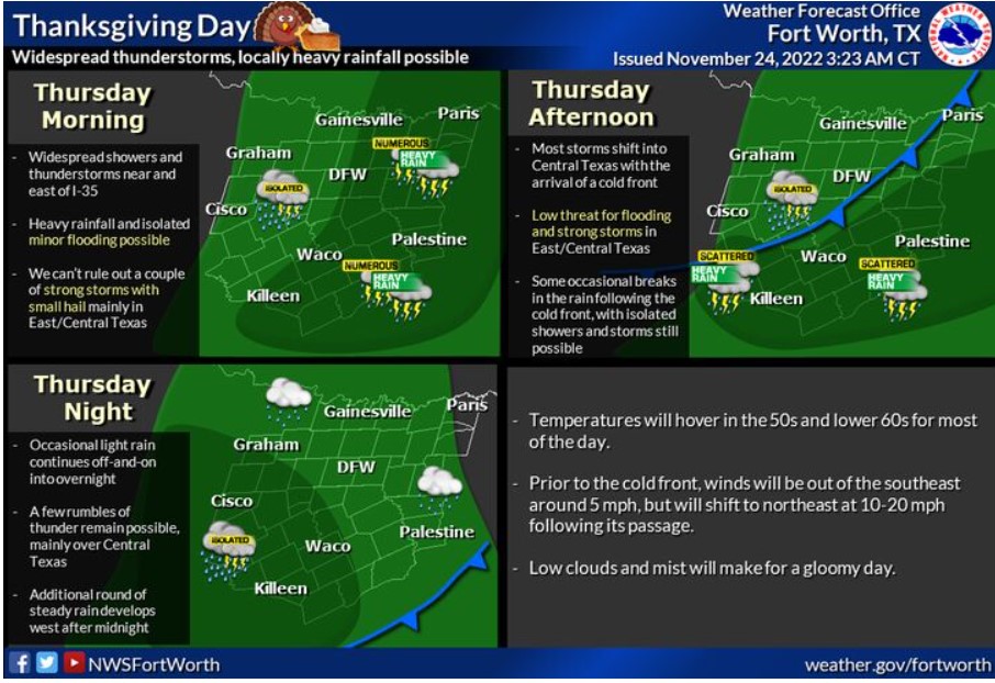
Numerous showers and scattered thunderstorms are expected today across Central and Eastern North Texas. Locally heavy rain and minor flooding are the primary threat, but a few strong to marginally severe storms are also possible across Central Texas this afternoon.
Friday through Wednesday
Isolated thunderstorms will remain possible Friday into Friday night. Do not expect any severe weather during this time.
SPOTTER INFORMATION STATEMENT
The NWS does not expect spotter activation at this time.
South Central and Southwest Arkansas, North Central and Northwest Louisiana, Southeast Oklahoma, and East and Northeast Texas
Today and Tonight
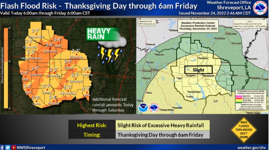
Rain chances will begin to increase into the afternoon hours today, ahead of an advancing trough. Some of this rain may be moderate to
heavy at times, and widespread two to four inches of rain are possible into the weekend.
Friday through Wednesday
Moderate to heavy rainfall will continue into the weekend before the trough exists in the region on Sunday. As another track moves into the area, the next chance for severe weather appears to be Tuesday, potentially Wednesday. While there is still a lot to come into the picture, damaging winds and isolated tornadoes could be the most significant threats.
SPOTTER INFORMATION STATEMENT
The NWS does not expect spotter activation at this time.