


North and Central Texas
Today and Tonight
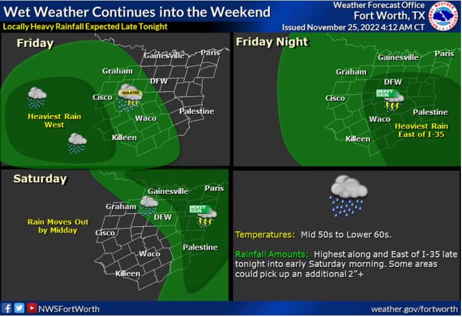
Expect scattered showers and thunderstorms through today, mainly west of I-35. Showers and thunderstorms will increase in coverage overnight tonight across all of North and Central Texas. Some locally heavy rainfall could cause some flooding in low lying areas, particularly east of I-35 late tonight into early Saturday morning.
Saturday through Thursday
Expect additional thunderstorms next Tuesday with the passage of a strong cold front.
SPOTTER INFORMATION STATEMENT
The NWS does not expect spotter activation at this time.
South Central and Southwest Arkansas, North Central and Northwest Louisiana, Southeast Oklahoma, and East and Northeast Texas
Today and Tonight
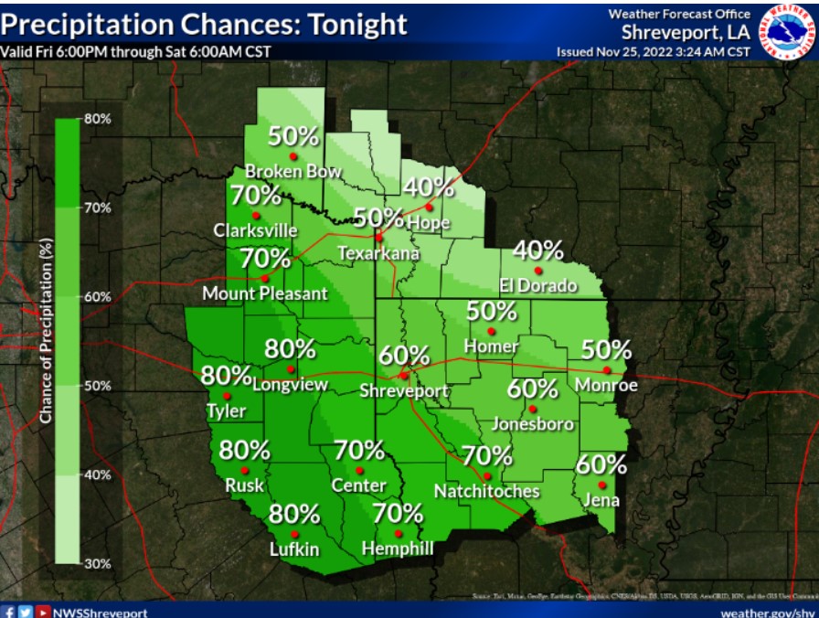
A few showers and thunderstorms will be possible across portions of deep east Texas this afternoon. Otherwise, dry and cloudy skies are expected today, with some clearing tonight.
Saturday through Thursday
Moderate to heavy rainfall will return on Saturday before the trough exists Sunday. There is an increasing chance for severe weather on Tuesday and Wednesday as another system moves into the region. There is still much uncertainty that will need to get refined over the next few days on timing and location.
SPOTTER INFORMATION STATEMENT
The NWS does not expect spotter activation at this time.