


North and Central Texas
Today and Tonight
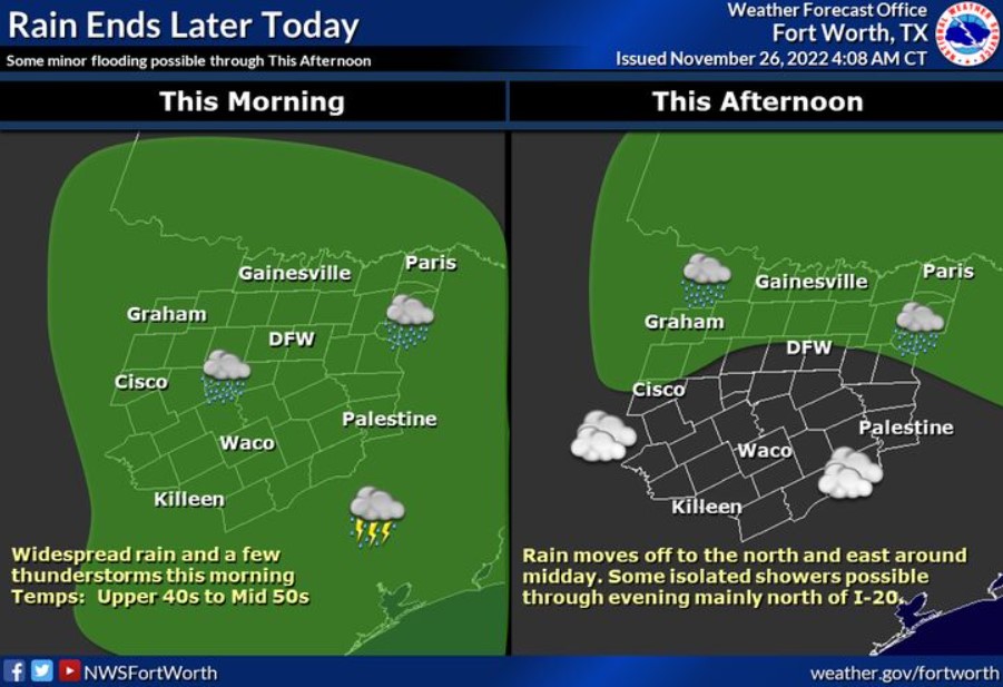
Areas of rain and embedded thunderstorms will continue across much of North and Central Texas today. Locally heavy rainfall and minor flooding will be the main threat, particularly east of I-35 through early afternoon. The strongest storms will produce frequent lightning and perhaps some small hail.
Sunday through Friday
Additional thunderstorms are possible next Tuesday with the passage of a strong cold front.
SPOTTER INFORMATION STATEMENT
The NWS does not expect spotter activation at this time.

South Central and Southwest Arkansas, North Central and Northwest Louisiana, Southeast Oklahoma, and East and Northeast Texas
Today and Tonight
Showers and thunderstorms will be possible across much of the ArkLaTex through the day today. It will bring moderate to heavy rainfall to the portions of the area. With saturated soils already out there, some localized Flash Flooding could be possible in flood-prone and low-lying areas.
Sunday through Friday.
There remains an increasing threat of severe weather on Tuesday and Wednesday as another system moves into the region. There is still much uncertainty that will need to get refined over the next
few days on timing and location, but all modes of severe weather will be possible.
SPOTTER INFORMATION STATEMENT
The NWS does not expect spotter activation at this time.