


North and Central Texas
Today and Tonight
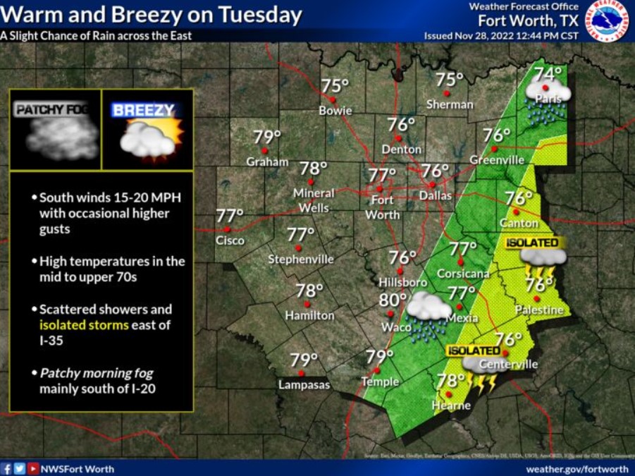
Isolated thunderstorms may occur east of a Canton to Hearne line mainly this morning. Lightning would be the main threat.
Wednesday through Monday.
Expect no hazardous weather at this time.
SPOTTER INFORMATION STATEMENT
The NWS does not expect spotter activation at this time.
South Central and Southwest Arkansas, North Central and Northwest Louisiana, Southeast Oklahoma, and East and Northeast Texas
Today and Tonight
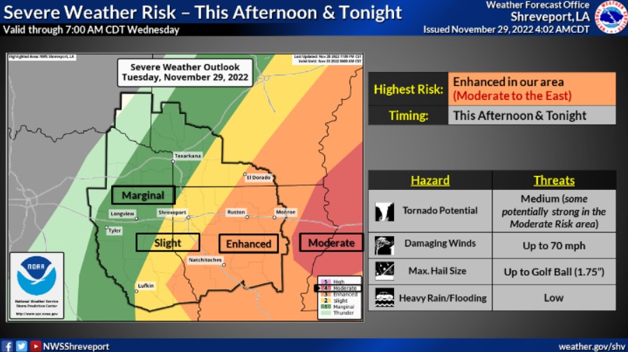
Showers and thunderstorms will increase across much of the region late this morning through the afternoon, ahead of a strong upper-level disturbance that will progress east through the Plains into the Mississippi Valley. Warm, moist, and unstable air will be in place across the area today ahead of this disturbance, which will fuel the threat of strong to severe thunderstorms, especially from portions of Deep East Texas into much of North Louisiana and Southcentral Arkansas. Damaging winds, large hail, and isolated tornadoes, some of which may be strong over Northcentral and Northeast Louisiana will all be possible before the storms and the severe weather threat diminish from west to east this evening ahead of a cold front that will move through the region.

Wednesday through Monday
Expect no hazardous weather at this time.
SPOTTER INFORMATION STATEMENT
The NWS does not expect spotter activation at this time.