


North and Central Texas
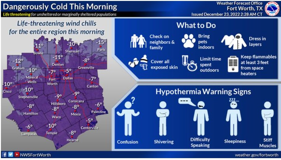
Frigid temperatures and strong winds will allow for dangerously cold wind chills this morning. If you don’t take precautions, these wind chills could result in hypothermia. Make sure to avoid extended time outdoors if possible, and if you have to brave the cold, then dress in layers and cover exposed skin.
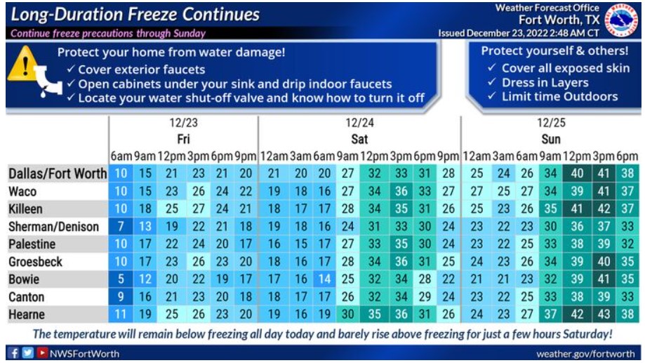
A prolonged period of subfreezing temperatures will continue into the Christmas weekend. Temperatures this cold for this long will damage exposed outdoor pipes! Ensure to follow the cold weather precautions and limit time spent outdoors through Sunday.
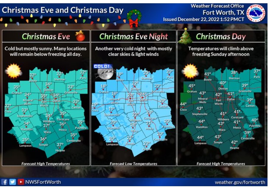
Expect continued cold temperatures on Saturday, with highs in the 30s. Many locations will stay below freezing. Christmas Day will start in the teens and 20s for lows and wind chills before warming up into the 40s and 50s for a mild Christmas Afternoon. Skies will be mostly clear, with winds around ten mph or less.
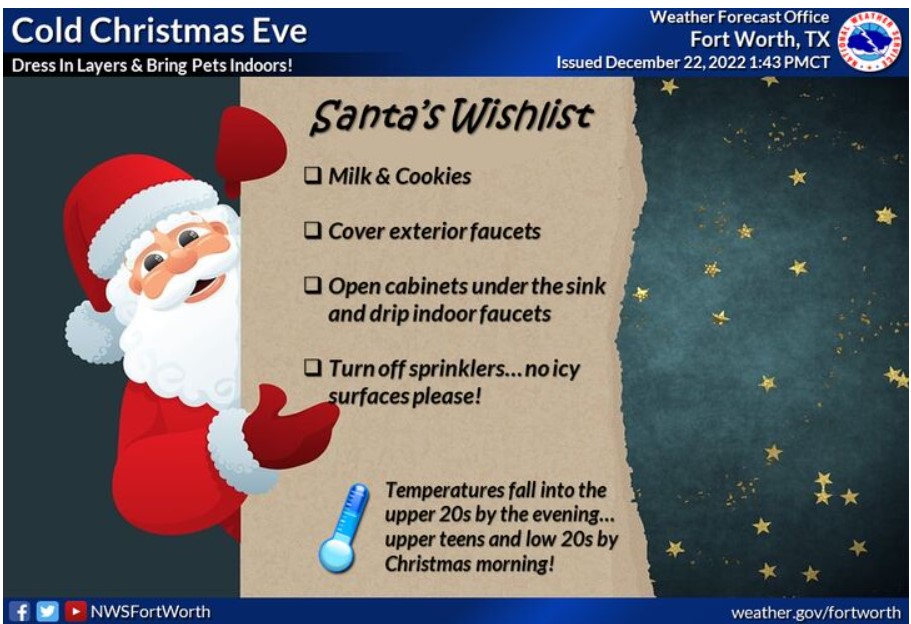
Expect a Cold Christmas Eve. Make sure you dress in layers and bring pets indoors! Temperatures will fall into the upper 20s by the evening and upper teens to low 20s by Christmas morning. Ensure your exterior faucets are covered and let the indoor faucets drip! Turn off sprinklers too. No icy surfaces, please!
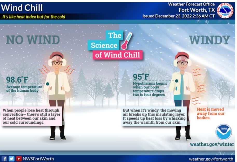
The Wind Chill is a measure to help describe the rate of heat loss from the human body resulting from the combined effect of low temperature and wind. Stronger winds help draw heat out of our body faster, resulting in a lower body temperature. Unfortunately, this increases the risk of hypothermia, which sets in when our body temperature drops just two to four degrees.
Today and Tonight
Gusty winds and sub-freezing temperatures will result in wind chills from 5 to 15 degrees below zero across the entire region this morning. A hard freeze this morning could damage unprotected pipes and faucets.
Saturday through Thursday
Sub-freezing temperatures will continue through at least Saturday morning for all areas, and again Saturday night into Christmas morning.
South Central and Southwest Arkansas, North Central and Northwest Louisiana, Southeast Oklahoma, and East and Northeast Texas
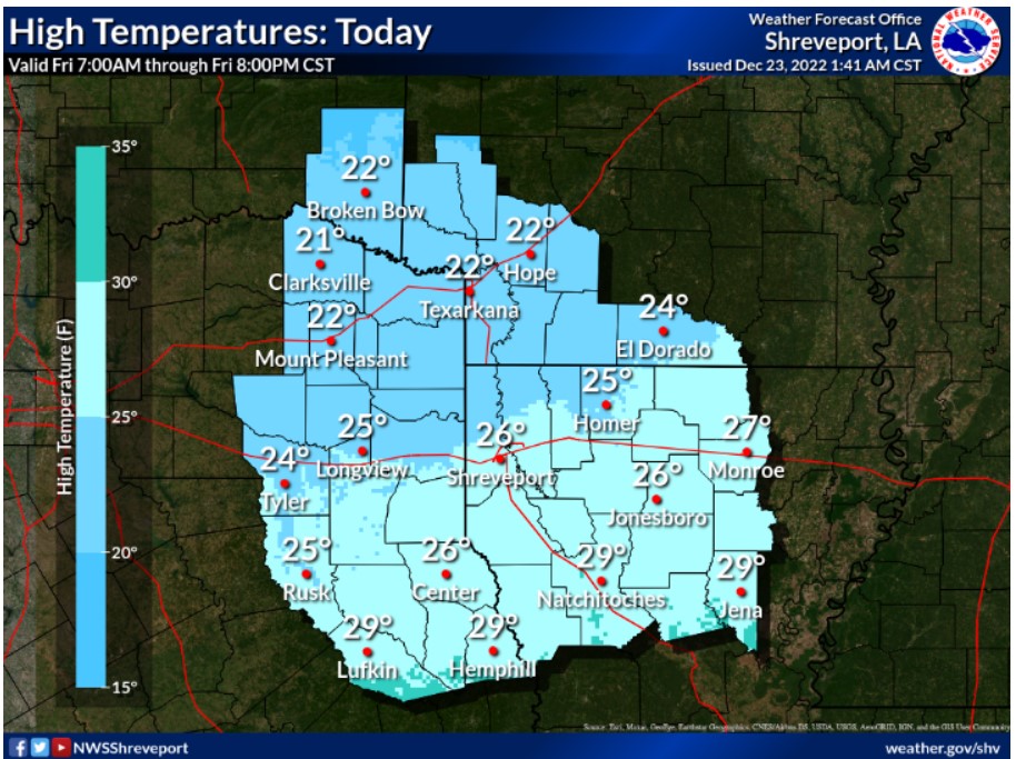
It will be cold and going for a high in the low to mid-20s. The wind through the day makes it feel like the single digits and down to mid-teens.
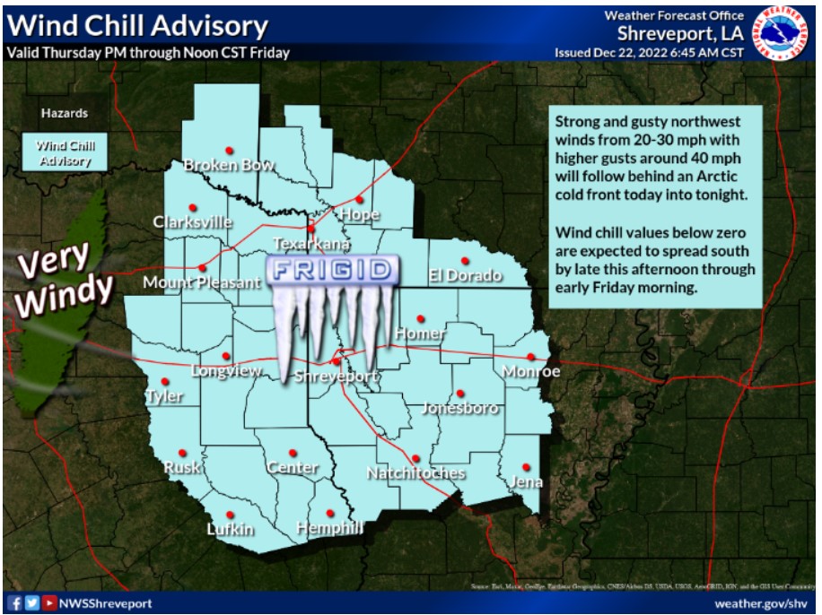
Wind chill values below zero are occurring behind this Arctic cold front, and they will linger through Friday morning, with strong winds from the NW producing dangerously cold wind chills.
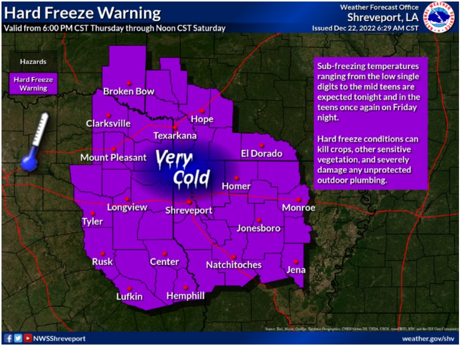
A Hard Freeze Warning will remain in effect through Noon on Saturday. It is the coldest air of the season during this time frame, with bitterly cold temperatures and even colder wind chills.
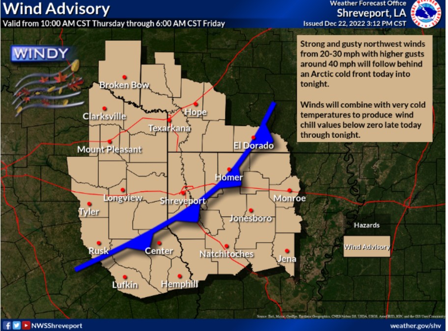
A strong blast of cold Arctic air has made its way to the Four State Area and will linger for much of the Christmas weekend. The pressure gradient with this front is very tight, resulting in sustained winds above 20 mph.
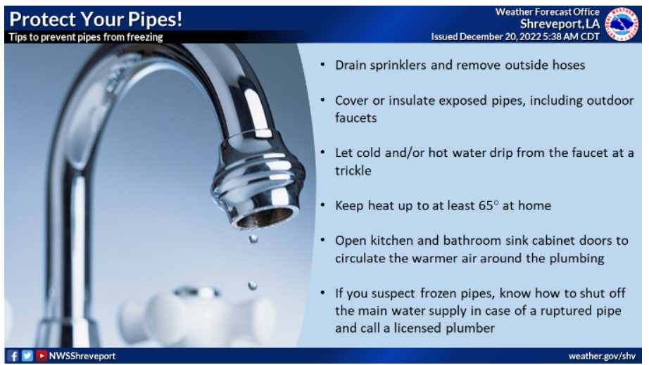
Temperatures have plummeted, so ensure you protect those pipes by following these quick safety tips.
Friday through Wednesday.
Winds will diminish throughout the day on Friday, but temperatures will remain below freezing all day, with lows Friday night falling
into the teens. Afternoon temperatures on Saturday will only climb into the lower and mid-30s, with the entire area climbing above freezing by Christmas afternoon. This warming trend will continue next week, with near-normal temperatures returning by Wednesday.