


North and Central Texas
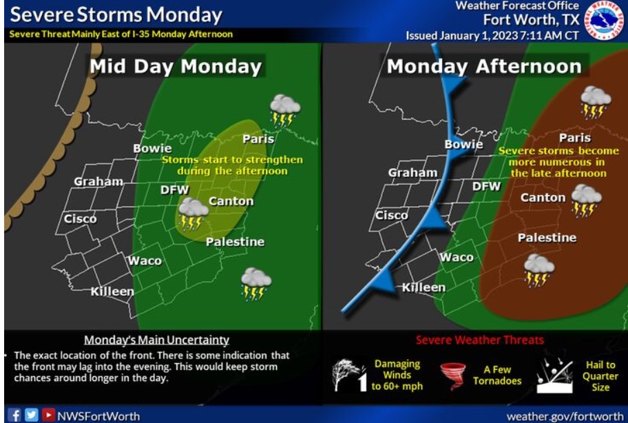
Expect thunderstorms to increase across parts of North Texas on Monday as a storm system moves through the Plains. Scattered showers and a few storms will be ongoing during the morning but will increase coverage through the afternoon, mainly east of I-35. Some storms during the afternoon will be severe and capable of producing damaging winds, tornadoes, and hail. These storms will move into East Texas during the evening hours. We’ll update the forecast over the next 24-36 hours.
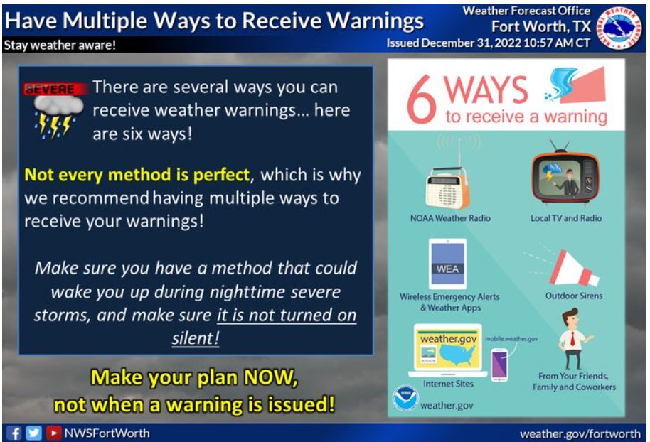
With the potential for severe weather on Monday afternoon and evening, now is an excellent time to ensure you can receive warnings! Only some methods are perfect, so you should have multiple plans. You can receive a notification in six different ways: from NOAA Weather Radio, local media, Wireless Emergency Alerts & weather apps, outdoor sirens, and internet sites such as weather.gov, as well as from family, friends, and coworkers.
South Central and Southwest Arkansas, North Central and Northwest Louisiana, Southeast Oklahoma, and East and Northeast
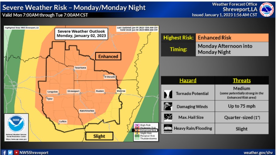
Expect strong to severe thunderstorms to develop across much of the Four State Region Monday afternoon and night. Damaging winds, isolated tornadoes, some of which could be strong, large hail, and locally heavy rainfall, which may result in minor flooding, will all be possible.

If you live in a mobile or manufactured home, it is essential to have a tornado evacuation plan. It is vital to evacuate before storms hit and move to a safer structure. An EF-1 tornado can destroy a single-wide manufactured home, and an EF-2 can destroy a double-wide.
Monday through Saturday
The new year looks to kick off with a bang, as severe weather already looks possible on Monday. All modes of severe weather are possible, including tornadoes. A few of these tornadoes may also be substantial, given the highly sheared environment.
SPOTTER INFORMATION STATEMENT
Spotter activation will likely be needed.