


North and Central Texas
Tuesday Night
Expect light snow across portions of North Texas this evening, with light accumulations on grass and elevated surfaces possible, primarily from the Big Country into Texoma. Ground temperatures will be too warm for widespread travel impacts, but some slick spots could be on bridges and overpasses.
Wednesday through Monday
A few thunderstorms are possible along and ahead of a cold front Saturday night, mainly east of the I-35 corridor.
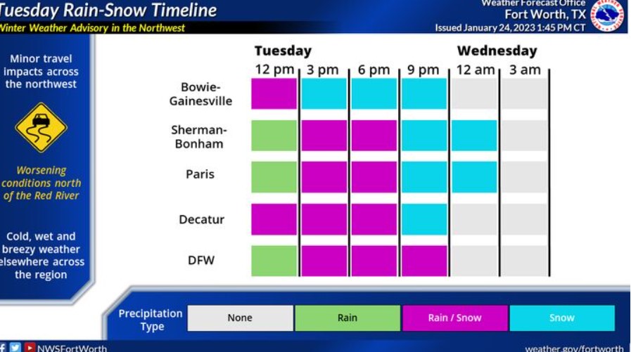
Expect widespread precipitation as a robust storm system moves overhead. Some of this precipitation will be snow, particularly along the Red River and the northwest portions of North Texas. The graphic indicates a timeline of expected rainfall at different regional points.
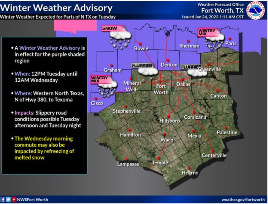
A Winter Weather Advisory is in effect for the purple-shaded region on the map from noon Tuesday through noon Wednesday. The affected area is western North Texas and the Texoma region, where you can expect minor travel impacts.
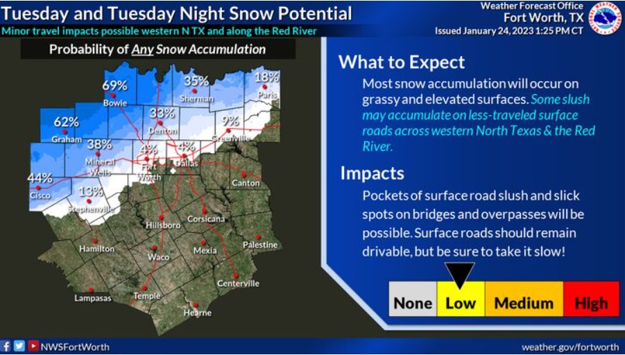
Above-freezing surface temperatures will limit snow accumulation. Therefore, any snow that falls will likely be wet and slushy. The collection is likely on grassy and elevated surfaces, especially across western North Texas and along the Red River Valley, where temperatures will be a little colder and where a snow mixture or transition to all snow will begin sooner. Please continue to monitor the forecast for updates!
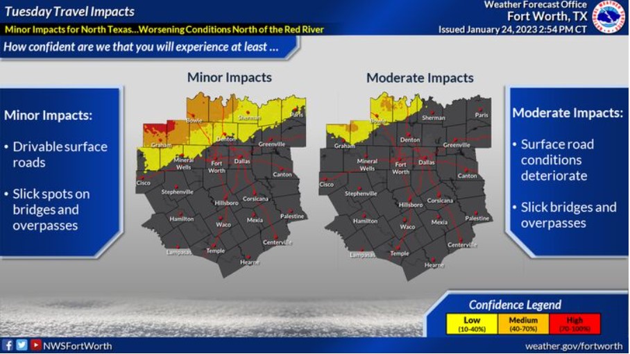
Expect minor travel impacts through Tuesday night. Light slushy snow accumulation on surface streets will be minimal and mostly confined to bridges or overpasses. However, moderate to heavy snow periods are possible across Northwestern North Texas and along the Red River, which would create brief travel impacts. Be sure to drive slowly and plan to add extra time to your commute if you have travel plans today and tonight.
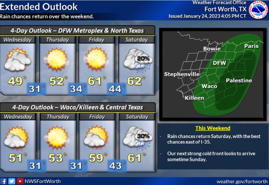
Cool temperatures are expected on Wednesday, with a slight warm-up into the low 60s through the weekend. Unfortunately, rain chances will also return on Saturday. Keep an eye on the forecast for possible changes and updates in the coming days!
South Central and Southwest Arkansas, North Central and Northwest Louisiana, Southeast Oklahoma, and East and Northeast Texas
Tonight
Wind Advisory In Effect Until 6:00 am Wednesday
Excessive rainfall is possible tonight as a strong upper-level disturbance impacts the region with widespread showers and isolated thunderstorms. Periods of heavy rainfall may create a flash flooding threat with one to two-inch rain amounts and isolated higher totals possible. Also, a Wind Advisory is in effect from noon today through 6:00 am on Wednesday, as most of the region will see winds from 15-25 mph, with stronger gusts as high as 40 mph.
Wednesday through Monday
Showers and isolated thunderstorms will return to the region by late
Saturday through Sunday. However, the National Weather Service expects no hazardous weather at this time.
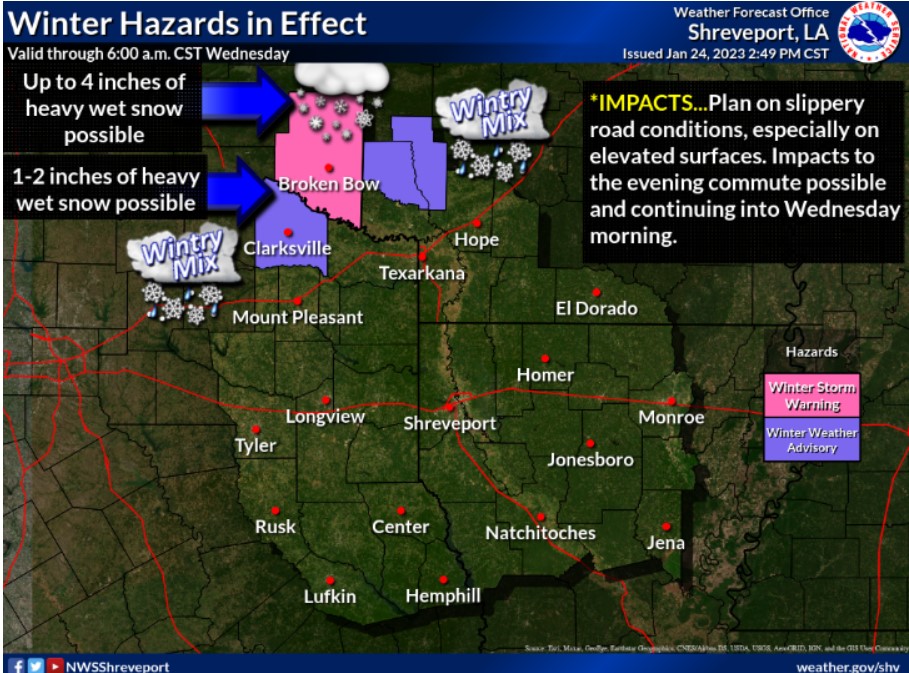
A Winter Storm Warning is in effect for McCurtain County, Oklahoma. A Winter Weather Advisory is also in effect north of I-30 through tonight. Snow accumulations will start slush, with slush and snow-covered roads becoming slick into the evening hours.
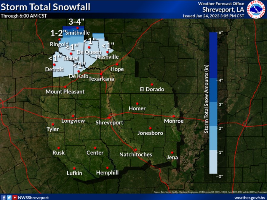
Up to an inch of snowfall will be possible for some areas in Northeast Texas and Southwest Arkansas, with localized amounts of up to four inches in northern McCurtain County, OK.
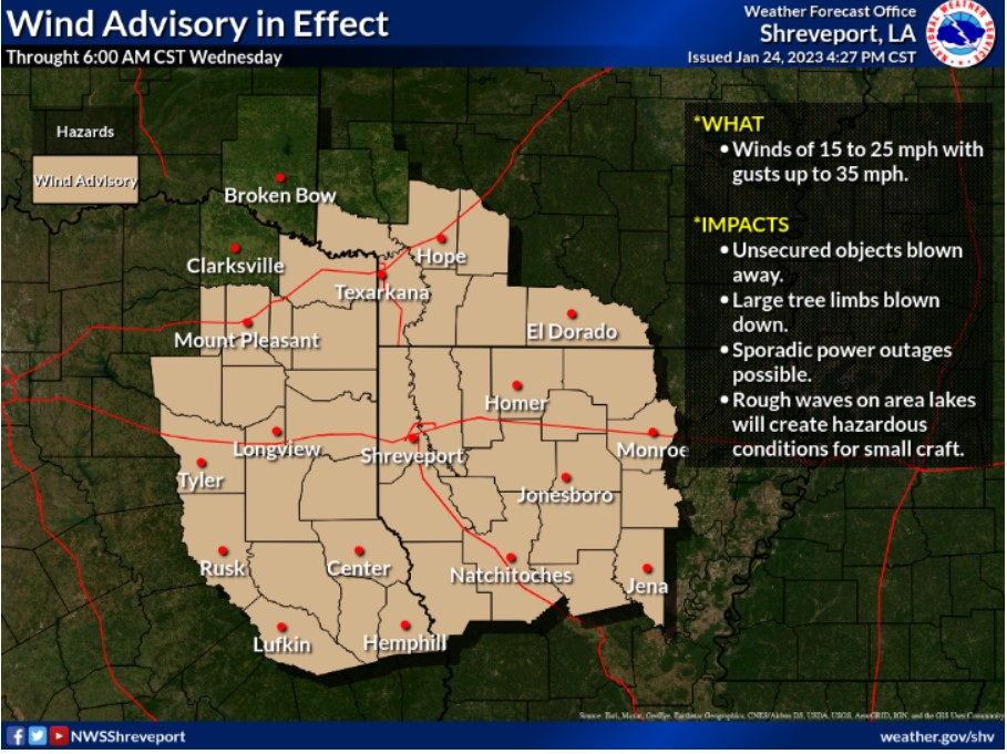
A Windy 24-hour period for us, with easterly winds shifting to the Northeast this evening and eventually Northwest by daybreak. A vigorous upper-level storm will tighten the pressure gradient with wind speeds of 15 to 25 mph and gusts to 35 to 40 mph.