


North and Central Texas
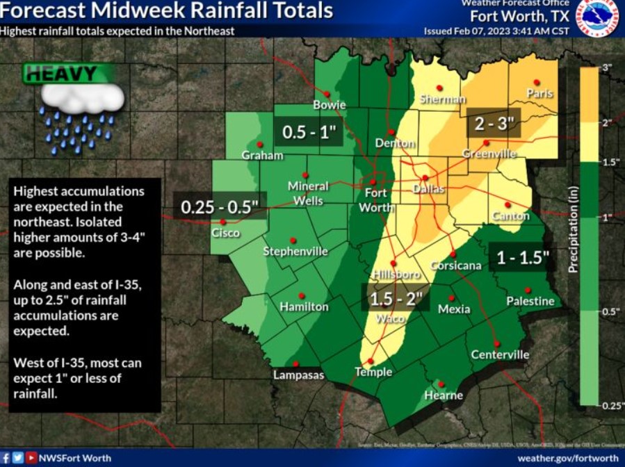
For areas along and east of I-35, you can expect up to 2.5″ of total rainfall accumulations. The highest rainfall totals should be in the northeast, where isolated higher totals of 3-4″ are possible. For areas mainly west of I-35, you can expect 1″ or less through Wednesday.
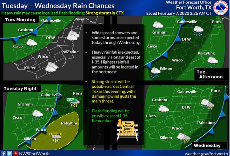
Rain chances return to North and Central Texas starting Tuesday morning as a mid-level system and cold front enters the region. Heavy rainfall will be possible Tuesday evening into Tuesday night, primarily along and east of the I-35 corridor. A few intense storms will be possible across portions of Central and East Texas, with damaging winds the primary concern.
Today and Tonight
Expect scattered thunderstorms today and tonight. Heavy rainfall and localized flooding will be possible, primarily along and east of I-35. Additionally, a few intense storms are possible across Central Texas this evening. Damaging wind gusts will be the main threat.
Wednesday through Monday
A few thunderstorms are possible through Wednesday afternoon. The main concern will be heavy rainfall which may result in flooding of
low lying and poorly drained areas.
SPOTTER INFORMATION STATEMENT
Do not expect spotter activation at this time.
South Central and Southwest Arkansas, North Central and Northwest Louisiana, Southeast Oklahoma, and East and Northeast Texas
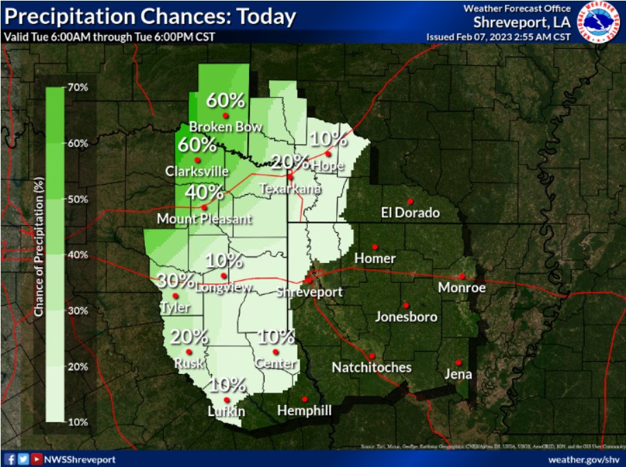
Showers and storms will primarily impact Southeast Oklahoma and northern portions of East Texas, only gradually creeping east as the day continues.
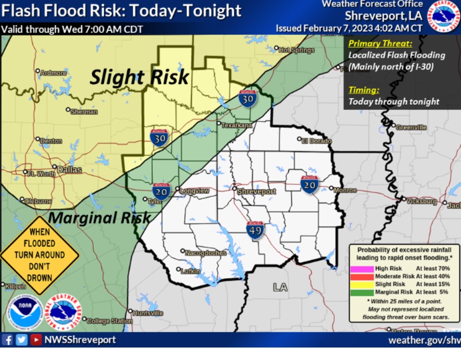
New rainfall accumulations may lead to flash flooding, mainly along and north of the I-30 corridor.
This afternoon and tonight
Patchy fog could become dense in a few locations overnight, but don’t expect widespread thick fog. Therefore, you should not expect any hazardous weather at this time.
Tuesday through Sunday
Showers and embedded thunderstorms will increase Tuesday night and Wednesday across East Texas and North Louisiana, along and ahead of an approaching dryline and associated upper-level storm system. Warm and humid air will continue to increase ahead of this system, resulting in instability Wednesday within a strongly sheared environment. Thus, the potential for strong to severe thunderstorms exists Wednesday, with damaging winds and an isolated tornado possible. In addition, locally heavy rainfall will also be possible, resulting in minor flooding of low-lying, poor drainage areas. It will also create another rise in area waterways. Afterward, cooler temperatures and drier conditions are expected Thursday through next weekend.
SPOTTER INFORMATION STATEMENT
Do not expect spotter activation at this time.