


North and Central Texas
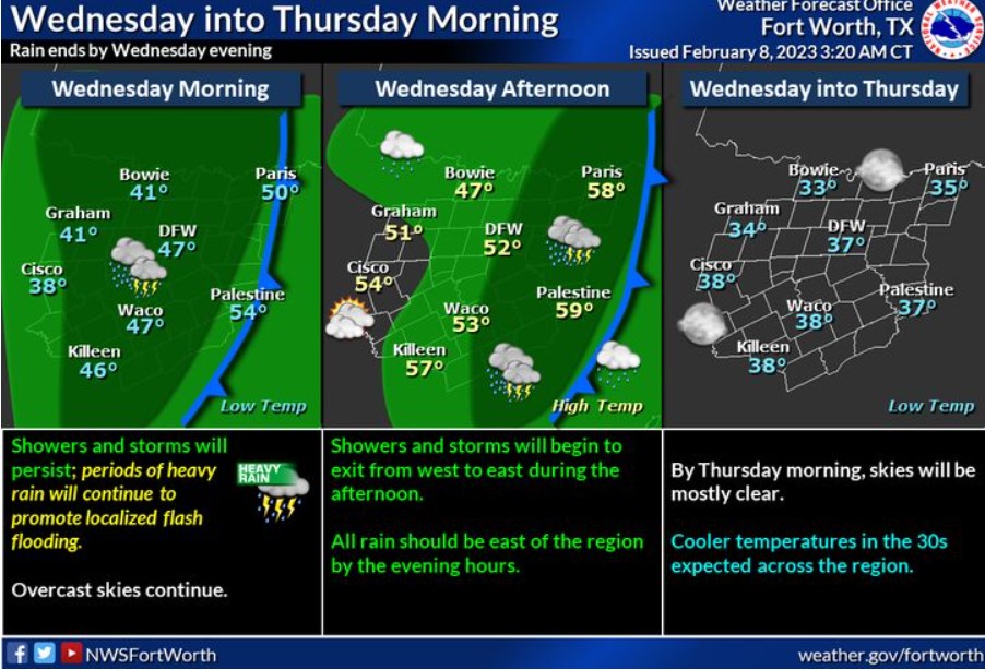
Chances for showers and storms will continue across North and Central Texas through Wednesday afternoon. Periods of heavy rain will allow for a continued flash flood threat. Remember never to drive through flooded roads! Over the afternoon, the rain will exit the region from west to east and end entirely by the evening hours. Clouds will be slower to go, and skies should be mostly clear by Thursday morning.
Today and Tonight
Expect scattered thunderstorms through this afternoon. Heavy rainfall may result in some flooding of urban, low-lying, and poorly
drained areas primarily along and east of I-35.
Thursday through Tuesday
Thunderstorms chances return to the area early next week.
SPOTTER INFORMATION STATEMENT
Do not expect spotter activation at this time.
South Central and Southwest Arkansas, North Central and Northwest Louisiana, Southeast Oklahoma, and East and Northeast Texas
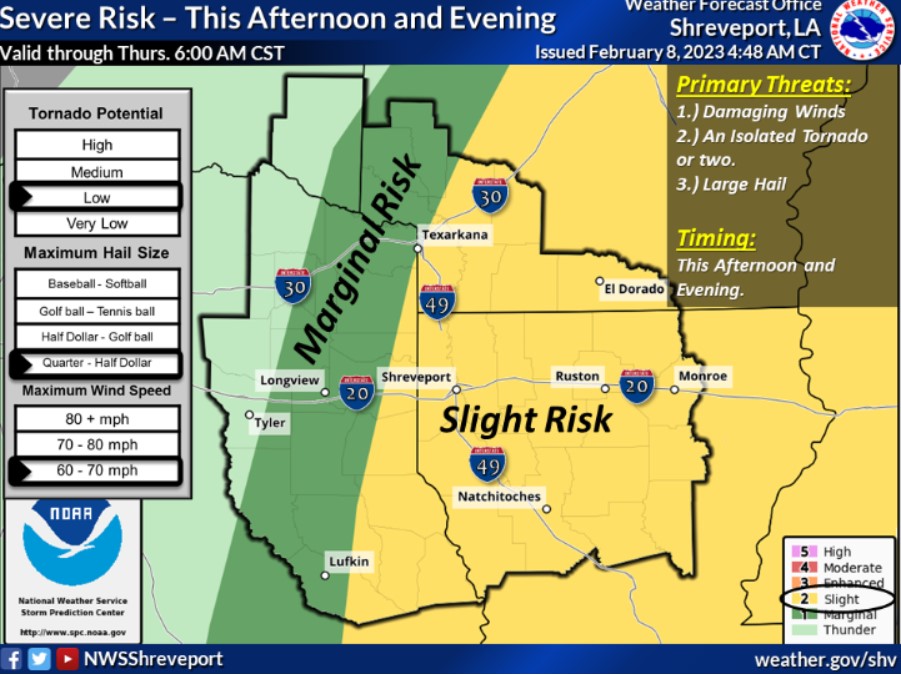
A Slight Risk for severe weather on Wednesday includes portions of Northwest and North-Central Louisiana, South-Central Arkansas, and the Toledo Bend area.
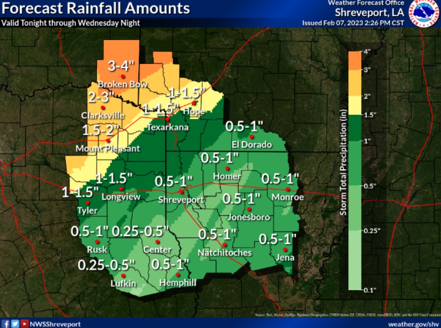
Heavier rainfall amounts tonight through Wednesday will fall across areas near and northwest of the I-30 Corridor of Northeast Texas, Southeast Oklahoma, and Southwest Arkansas. As a result, some minor flooding could materialize where heavier rain bands form through Wednesday.
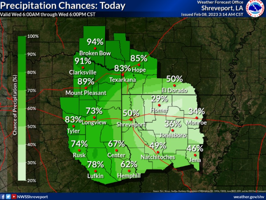
Rainfall will continue across portions of Northeast Texas, Southeast Oklahoma, and Southwest Arkansas, spreading eastward across Northwest Louisiana into the morning and afternoon hours.
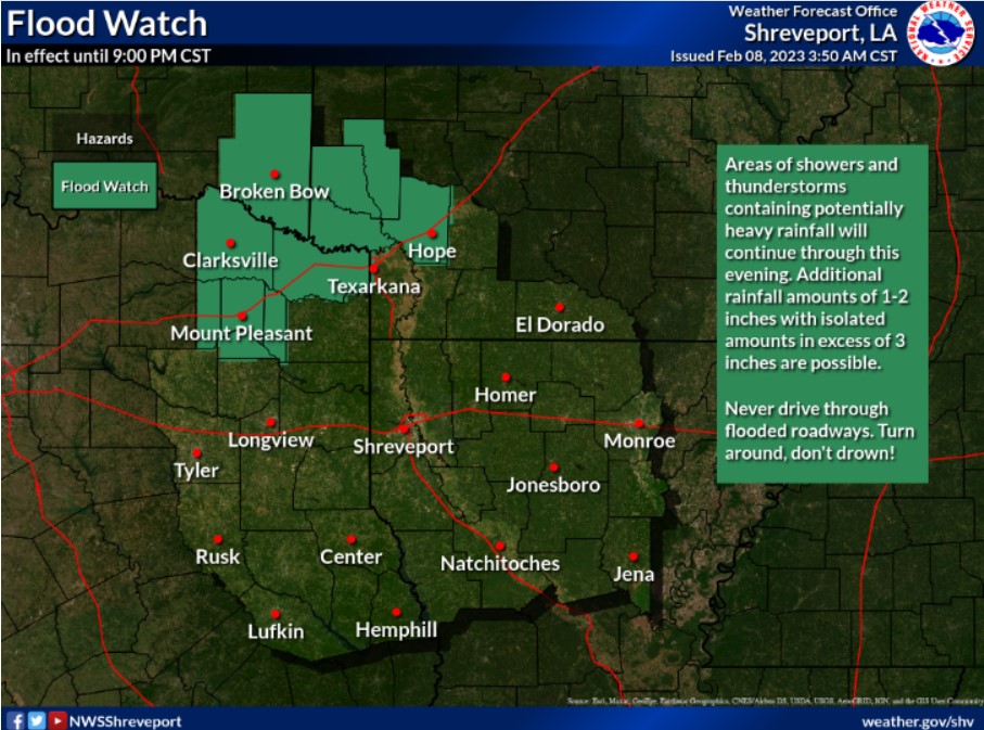
Portions of Southwest Arkansas, Southeast Oklahoma, and Northeast Texas will see continued heavy rainfall with accumulations of 1-2 inches possible.
This afternoon and tonight
Expect showers and embedded thunderstorms to increase through tonight across Northeast Texas, Southeast Oklahoma, and adjacent sections of Southwest Arkansas, along and just ahead of a cold front that will become stationary over the area by this evening. Locally heavy rainfall will be possible tonight, which may result in minor flooding of low-lying, poor drainage areas.
Wednesday through Monday
Showers and embedded thunderstorms will continue through much of Wednesday across Northeast Texas, Southeast Oklahoma, and Southwest Arkansas, before gradually diminishing from west to east during the late afternoon and early evening. Locally heavy rainfall will be possible Wednesday, resulting in minor flooding of low-lying, poor drainage areas. Cooler temps and drier conditions will return to the region late tonight through the weekend before showers increase on Monday.
SPOTTER INFORMATION STATEMENT
Spotter activation may be needed tonight for rainfall and flood
reports.