


This Hazardous Weather Outlook is for portions of South Central and Southwest Arkansas, North Central, and Northwest Louisiana, Southeast Oklahoma, and East and Northeast Texas.
The combination of the hot temperatures and relative humidity
values will result in afternoon heat index values from near 100 to 103 degrees. Precautions should be taken to limit heat-related illnesses for those venturing out or working during the heat of
the day. The weather is not expected to be hazardous.
Sunday through Friday
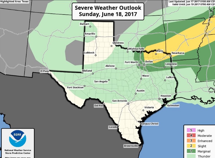
An upper-level disturbance will be moving around and through the base of an upper-level trough across the middle sections of the country Sunday, driving a cold front into the Four State Region. Isolated to scattered thunderstorms, some of which will be severe and mainly accompanied by the risk for potentially damaging wind gusts, are possible Sunday afternoon and evening across the Mid-South and into Arkansas and Northeast Texas. The cold front/leading outflow will be a focus for thunderstorm development with a rich low-level supply of moisture that will result in an unstable boundary layer. Hail and the wind will be the primary threats with the stronger storms. The activity gradually weakens during the evening.
SPOTTER INFORMATION STATEMENT
Through tonight the activation of emergency management personnel, amateur radio operators, and storm spotters is not needed. That could change Sunday afternoon and evening.