


This Afternoon and Tonight
North and Central Texas.
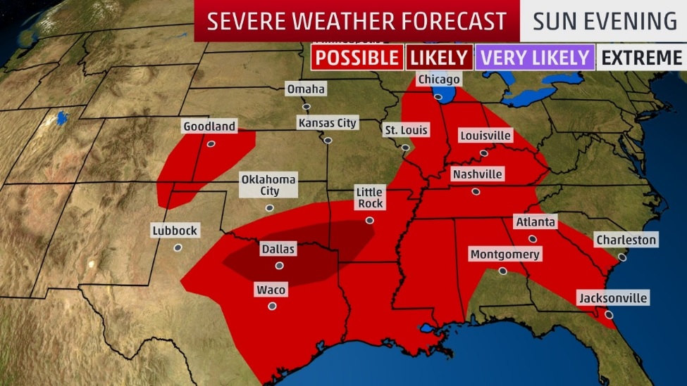
A complex of thunderstorms will move across North Texas tonight, bringing a threat for damaging winds, large hail, and isolated tornadoes. Heavy rainfall and localized flash flooding are also possible. As the storms move south of the I-20 corridor late this evening, the severe threat will begin to decrease, but the danger for heavy rainfall and some flooding will continue.
South Central Arkansas, Southwest Arkansas, North Central Louisiana, Northwest Louisiana, East Texas, and Northeast Texas.
A frontal boundary will push southeast into the area this afternoon into tonight, bringing two rounds of severe weather. The first round, late this afternoon into the early evening hours will bring the threat of damaging winds and large hail. The second round, late this evening into the overnight hours, will bring the risk of damaging winds with embedded isolated tornadoes possible. Localized flash flooding will be possible this evening and tonight.
Monday through Saturday
Scattered thunderstorms are possible on Monday. A threat for intense storms and additional heavy rainfall could exist through the day. Low thunderstorm chances will continue Tuesday through Saturday, mostly during the afternoon and evening hours each day. The most significant opportunities will be along and east of I-35.
An unsettled pattern will set up over the Four State Region for the upcoming week. For the most part, daytime heating will lead to the chance for showers and thunderstorms to remain in the forecast through next weekend. Some of the stronger storms may produce locally gusty winds and brief, heavy rainfall each day. Localized flash flooding will be possible with slower moving storms through this period.
SPOTTER INFORMATION STATEMENT
Spotter activation is likely north of the I-20 corridor through 10:00 pm with some spotter activation possible south of I-20 late this evening and overnight. In Northeast Texas, the activation of emergency management personnel, amateur radio operators and storm spotters are requested this afternoon through Monday morning.