


Hazardous weather outlook for portions of Southeast Oklahoma, and Northeast Texas
A Flash Flood Watch remains in effect until 7:00 pm this evening. Look for additional showers and thunderstorms across the region through this evening as an upper-level disturbance moves into the southern plains today. An additional rainfall amount of one to three inches is possible that could result in flash flooding.
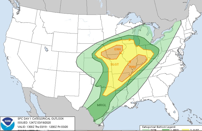
There will be a chance for strong to severe thunderstorms today through this evening ahead of the cold front that should begin moving into the area around Sunrise Friday. Damaging wind and hail could develop today through this evening.
Friday through next Wednesday
Some post-frontal showers and thunderstorms are possible Friday before moving south and east of the region by Friday evening. We should see a dry Saturday before the rain, and a few storms return for late Saturday into Sunday. Thunderstorms this weekend should not be severe.
SPOTTER INFORMATION STATEMENT
The activation of emergency management personnel, amateur radio operators, and storm spotters could be necessary for flooding and possible development of strong to severe thunderstorms through this evening.