


South Central Arkansas, Southwest Arkansas, North Central Louisiana, Northwest Louisiana, Southeast Oklahoma, East Texas, and Northeast Texas.
Today
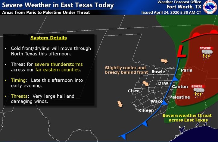
The severe thunderstorm threat will increase late this afternoon through this evening across much of the region, ahead of a strong upper-level storm system and associated cold front that will approach the area from the west. Damaging winds, large hail, and isolated tornadoes will be possible as these storms quickly spread east, and will exit the region and weaken by midnight tonight.
Saturday through Thursday
Dry conditions are expected Saturday through Monday, but showers and thunderstorms will begin to increase Tuesday and Tuesday night areawide ahead of another upper-level disturbance and associated cool front. While the threat for strong to severe thunderstorms can not be ruled out, the danger for heavy rainfall will exist as well, which may lead to localized flooding. Any severe weather or flood threat will diminish by Wednesday morning as much drier air spills southeast in the wake of this upper-level disturbance and cool front.
SPOTTER INFORMATION STATEMENT
Activation of emergency management personnel, amateur radio operators, and storm spotters will be needed late this afternoon through this evening. Please relay any information about observed severe weather to the NWS while following all local, state, and CDC guidelines.