


North and Central Texas
Today and Tonight.
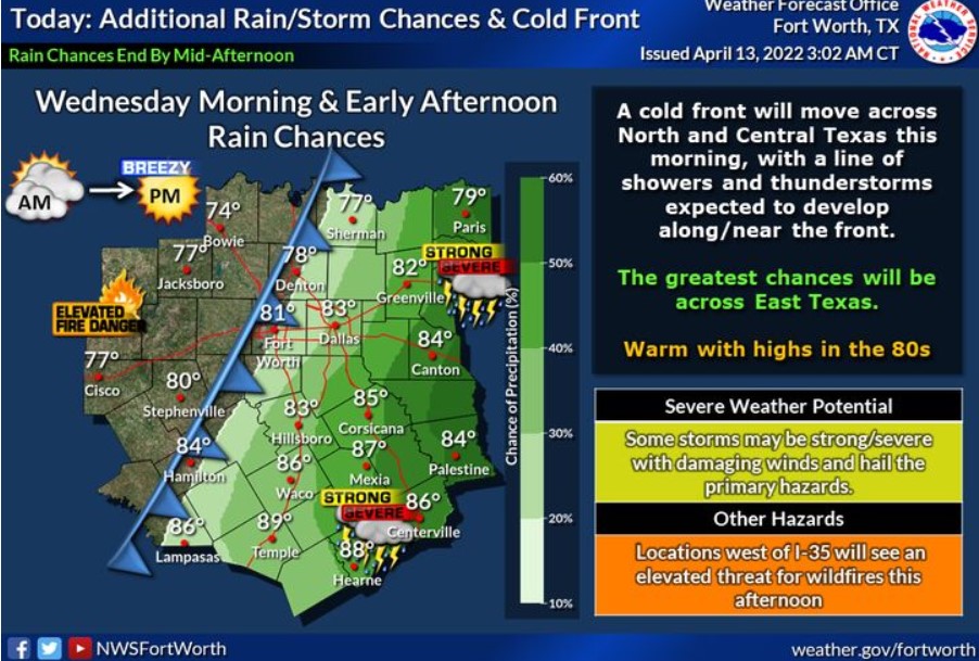
A cold front will move across the region Wednesday morning and early afternoon, with a line of thunderstorms expected to develop along the front. The most excellent chances will be across East Texas. Some storms may be severe, with damaging winds and hail as the primary hazards. Additionally, locations west of I-35 will have an elevated threat of wildfires. Cloudy skies will clear from west to east behind the front, and wind speeds will increase.
Sunny, warm, dry, and breezy conditions will lead to an elevated chance of grass fires this afternoon for locations west of the I-35 corridor that did not receive much rainfall on Tuesday.
Thursday through Tuesday
Isolated to scattered thunderstorms are possible across North and Central Texas Friday through Monday, with the best chances east of the I-35 corridor.
SPOTTER INFORMATION STATEMENT
The NWS does not expect the activation of spotters at this time.
South Central and Southwest Arkansas, North Central and Northwest Louisiana, Southeast Oklahoma, and East and Northeast Texas
Wednesday through Monday
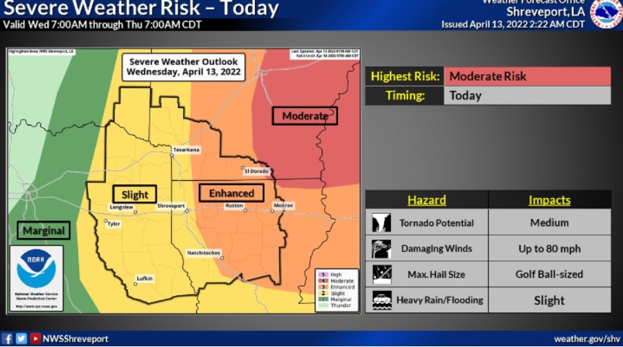
Chances for thunderstorms will remain across the area on Wednesday ahead of a cold front. Some of these storms may be severe, with all modes of severe weather possible. Heavy rainfall will also remain a possibility, leading to localized flooding. Expect dry weather on Thursday, but thunderstorm chances will return by Friday and through the upcoming weekend.
SPOTTER INFORMATION STATEMENT
There will be the need to activate emergency management personnel, amateur radio operators, and storm spotters through Wednesday.