


Tuesday through Sunday
North and Central Texas.
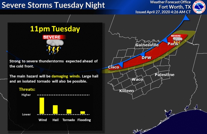
Storm chances will increase Tuesday evening again and continue through the night as a line of thunderstorm emerges out of Oklahoma and moves across North and Central Texas. The main threat will be damaging winds but don’t rule out a few instances of large hail and an isolated tornado.
Storm chances will end early Wednesday morning, leaving behind dry conditions through Saturday. Storm potential will increase Sunday, but severe storms appear unlikely at this time.
South Central Arkansas, Southwest Arkansas, North Central Louisiana, Northwest Louisiana, Southeast Oklahoma, East Texas, and Northeast Texas.
Isolated to scattered showers and thunderstorms will be possible across the region Tuesday, as a warm front lifts north across the area. Showers and thunderstorms are expected to develop late Tuesday afternoon along and ahead of an approaching cold front over Eastern and Central Oklahoma, and advance southeast into the region Tuesday evening. Expect these storms to intensify and become intense or severe as they progress into the area, with damaging winds, large hail, and isolated tornadoes possible. Locally heavy rainfall will be possible in the stronger storms as well, which may result in localized flooding. These showers and thunderstorms will gradually weaken by early Wednesday morning and quickly diminish from northwest to southeast across the region through midday Wednesday.
SPOTTER INFORMATION STATEMENT
Activation of emergency management personnel, amateur radio operators, and storm spotters through tonight are not needed. Please relay any information about observed severe weather to the NWS, while following all local, state, and CDC guidelines.