


North and Central Texas
Today and Tonight
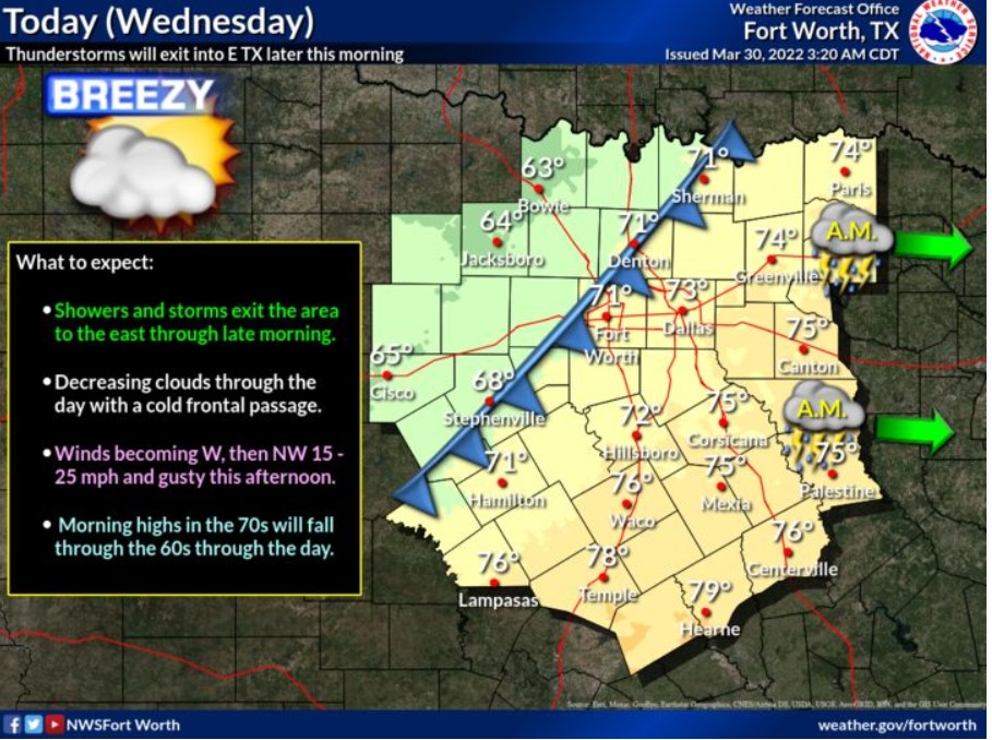
Expect thunderstorms to move through most of North and Central Texas and some of these will be severe, with damaging winds and
tornadoes being the main threats. Non-thunderstorm wind gusts of up to 45 mph will continue through the early morning hours out east and in advance of the line of storms moving through the area.
Wednesday through Monday
There is a low chance of storms late Friday night, mainly north of I-20 and across all of North and Central Texas late Monday. At this
time, the NWS does not anticipate severe weather. Better thunderstorm chances return early next week, but details regarding threats and coverage are uncertain.
SPOTTER INFORMATION STATEMENT
The NWS could request limited spotter activation along and east of I-35 this morning.
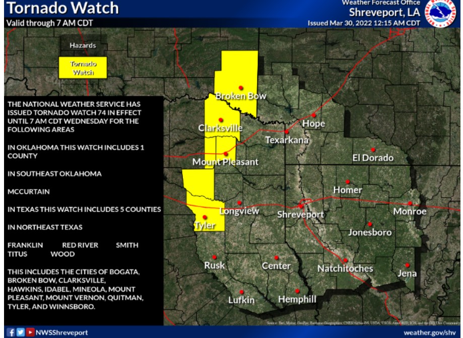
South Central and Southwest Arkansas, North Central and Northwest Louisiana, and East and Northeast Texas
Today and Tonight
Strong to severe thunderstorms will be possible today, capable of producing solid and damaging wind gusts, large hail, and isolated tornadoes. Locally heavy downpours will also accompany this activity today. In addition, strong winds outside of thunderstorms will continue, with gusts upwards of 50 mph possible today. This activity will exit the region from west to east by later this morning through late this afternoon as a cold front moves across the region. The Storm Prediction Center in Norman will extend the Tornado Watch this morning.
Thursday through Tuesday
Expect no hazardous weather.
SPOTTER INFORMATION STATEMENT
Activation of emergency management personnel, amateur radio operators, and storm spotters will be needed today. Please relay any information about observed severe weather to the NWS while following all local, state, and CDC guidelines.