


North and Central Texas
Tonight
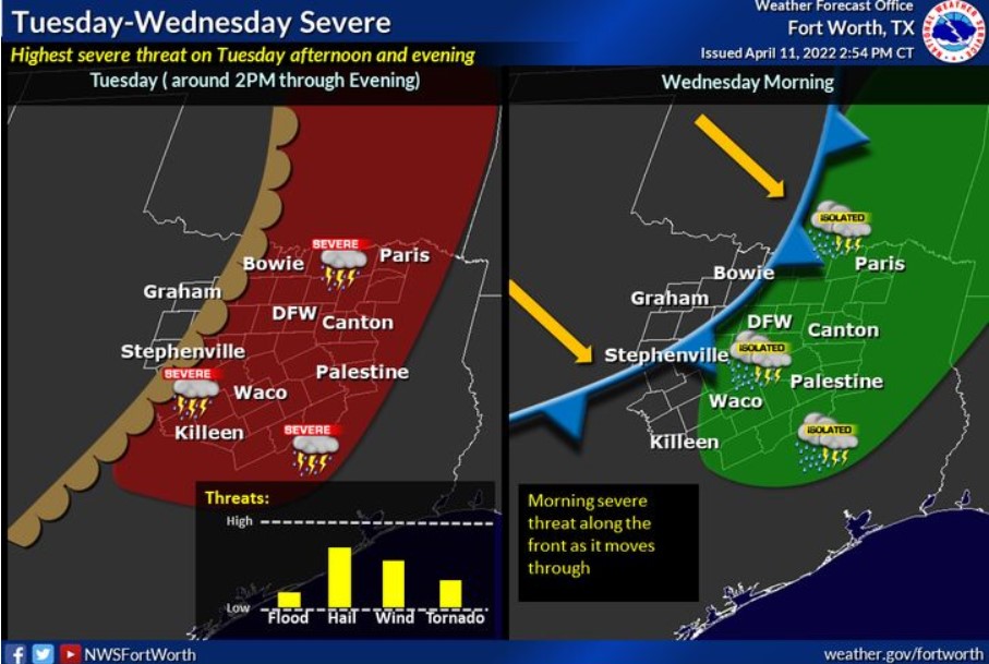
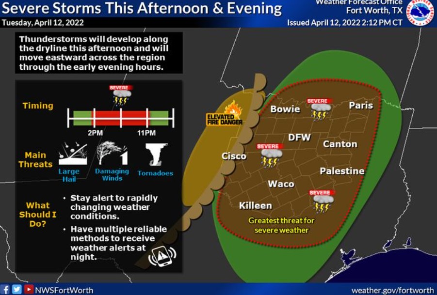
Thunderstorms are possible across nearly all of North and Central Texas this evening and tonight with a potential for severe storms. The primary hazards are large hail and damaging winds, but a few tornadoes are also possible.
There is an elevated fire threat this afternoon west of US-281 where dry, warm, and breezy weather take over.
Wednesday through Monday
Thunderstorm chances continue Wednesday morning, especially south of I-20 and east of I-35. Some thunderstorms may be severe, with damaging winds and hail the most likely hazards.
The fire threat will become elevated west of I-35 Wednesday afternoon when it becomes windy and dry behind a weak cold front.
There is a slight chance of thunderstorms Friday through Monday across much of North and Central Texas.
SPOTTER INFORMATION STATEMENT
The NWS could activate spotters across North and Central Texas this evening.
South Central and Southwest Arkansas, North Central and Northwest Louisiana, Southeast Oklahoma, and East and Northeast Texas
Tonight
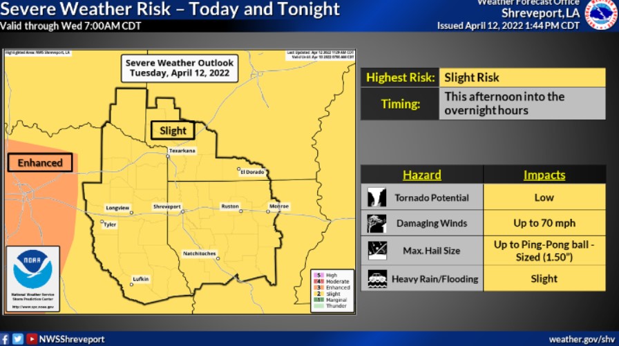
Chances for showers and thunderstorms will return to the area this evening. Some storms may be severe, with all modes of severe weather possible. Heavy rainfall will be possible with some thunderstorms, leading to localized flooding.
Wednesday through Monday
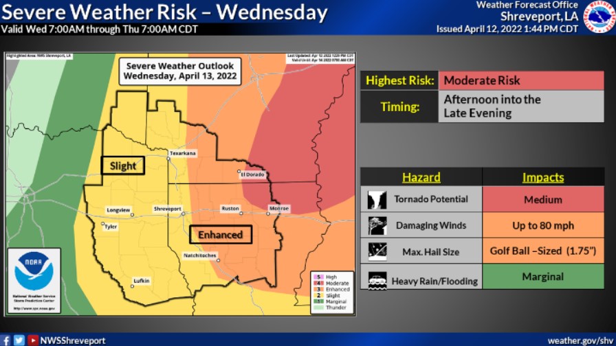
Chances for thunderstorms will remain across the area on Wednesday ahead of the cold front. Some of these storms may be severe, with all modes of severe weather possible. Heavy rainfall will also remain a possibility, leading to localized flooding. Expect dry weather on Thursday, but thunderstorm chances will return by Friday and through the upcoming weekend.
SPOTTER INFORMATION STATEMENT
The NWS will need activation of emergency management personnel, amateur radio operators, and storm spotters through Wednesday.