


This Hazardous Weather Outlook is for North and Central Texas.
This Afternoon and Tonight.
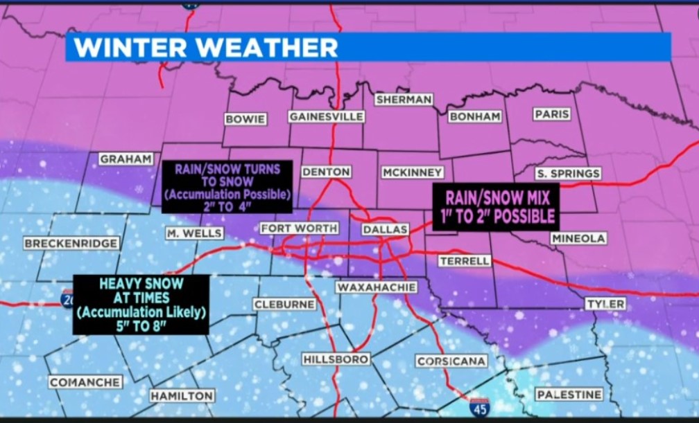
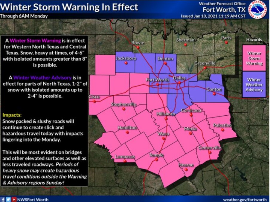
Snow, heavy at times, will continue across much of North and Central Texas this afternoon and into tonight. The most significant snowfall totals are anticipated south of the Jacksboro, D/FW, to Canton line. Snow-covered roads will result in slick and hazardous driving conditions.
Monday through Saturday.
The National Weather Service does not expect any hazardous weather.
This Hazardous Weather Outlook is for portions of Southwest Arkansas, North-Central Louisiana, Southeast Oklahoma and
Northeast Texas.
This Afternoon and Tonight
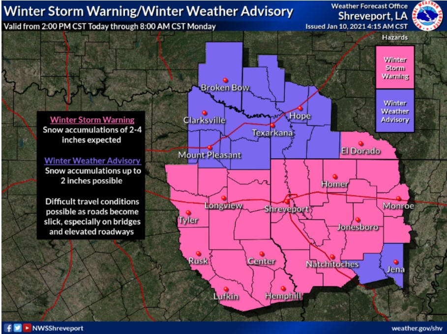
A strong winter storm will move into the region this afternoon, bringing widespread snow to the area through early Monday morning.
A Winter Storm Warning is in effect during this period. Expect a total snowfall accumulation of 2 to 4 inches with isolated higher amounts possible through Monday morning. The potential for the icing on bridges, overpasses, and any elevated roadways will be of most concern by the Monday morning commute as the air temperature will be below freezing.
Monday through Saturday
Conditions will improve across the area by Monday afternoon. High temperatures will approach near 40 degrees, allowing for some
melting to occur. Areas that get the higher amounts of snow will possibly see some refreezing Monday night into Tuesday morning. Exercise caution on Tuesday morning due to the potential for slick spots, especially on bridges and overpasses.
SPOTTER INFORMATION STATEMENT
Spotter activation will not happen at this time, but timely reports of snow amounts and impacts are appreciated.