


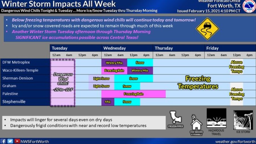
North and Central Texas.
Monday Night
Extreme wind chills will continue Monday night with values as low as -15 to -20 degrees. Actual air temperatures will fall to near -5, along
the Red River to near 5 degrees across Central Texas.
Tuesday through Sunday
Expect icy conditions through Wednesday, with low temperatures in the single digits highs in the teens and 20s. Wind chills below zero are likely through Tuesday morning and again on Thursday morning for the west of I-35.
Another significant winter storm is expected late Tuesday night into
Wednesday across all of North and Central Texas. A mix of freezing
rain and sleet will transition over to snow for areas north of I-20, with mainly freezing rain and sleet south of I-20. Expect additional travel impacts.
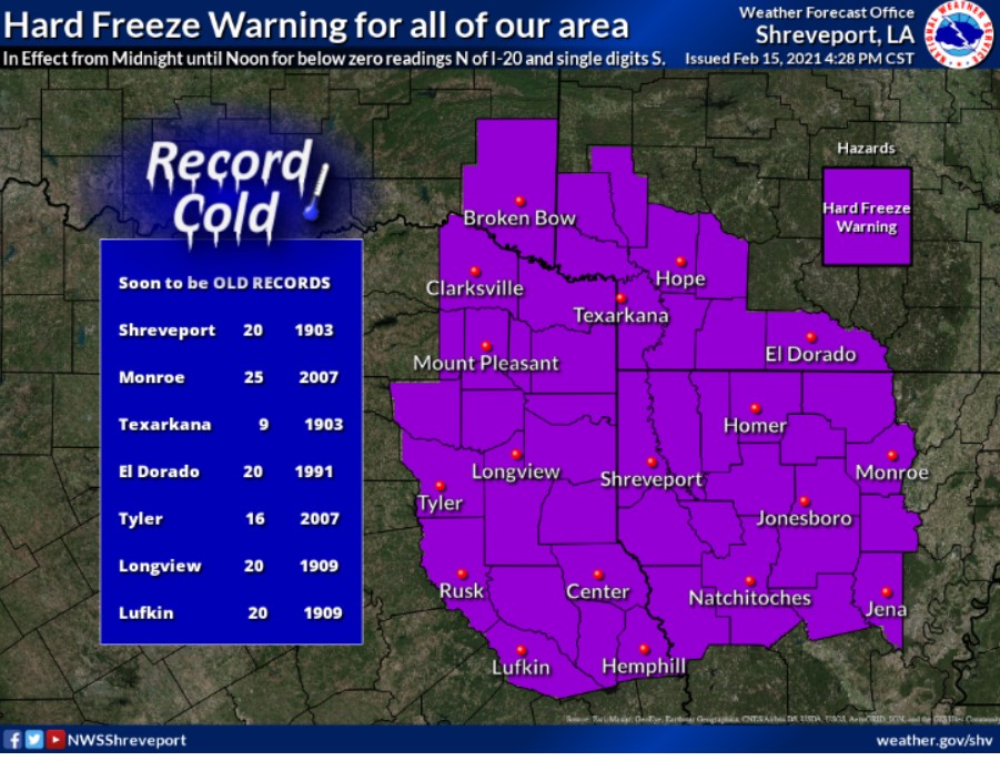
South -Central and Southwest Arkansas, North-Central, Northwest Louisiana, Southeast Oklahoma, East Texas, and Northeast Texas.
Monday Night
The winter storm warning expires Monday at 6:00 pm. Driving will still be hazardous throughout the night. Behind this sleet and snow, expect single-digit temperatures overnight. There is a Hard Freeze Warning in effect until 6:00 am Tuesday.
Tuesday through Sunday
Another winter storm will begin impacting the region late Tuesday night with a widespread wintry mix again Wednesday and Wednesday night before exiting late Thursday. Significant ice and snow accumulations will be possible with this midweek winter storm as well.