


North and Central Texas
Today and Tonight.
Scattered to numerous thunderstorms are expected this afternoon and
evening. Some storms may become intense or severe, with hail and
damaging winds as the main threats, especially across North Texas.
We can`t rule out a brief tornado or two.
Tuesday through Sunday.
Another round of thunderstorms will be possible on Wednesday. A firm or marginally severe storm will likely be across the Southeast late Wednesday afternoon and evening.
SPOTTER INFORMATION STATEMENT
Spotter activation is possible across North Texas late the afternoon and tonight. The most likely time for activation for locations west
of I-35 will be between 5:00 pm and 10:00 pm and between 8:00 pm, and 1:00 am East of I-35.
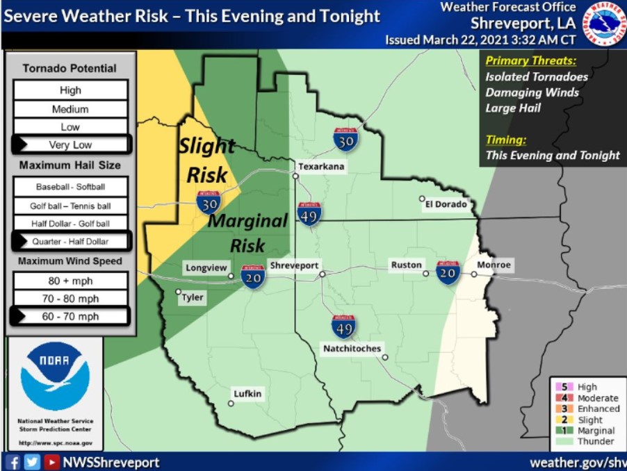
This Hazardous Weather Outlook is for portions of South-Central and Southwest Arkansas, North-Central and Northwest Louisiana, Southeast Oklahoma, East, and Northeast Texas.
Today and Tonight
Showers and thunderstorms will increase in coverage across the
region, mainly this evening and tonight. Some storms may become
severe across portions of Northeast Texas and Southeast Oklahoma.
Hail, damaging winds, and isolated tornadoes will be the main
threat.
Tuesday through Saturday
Another round of showers and thunderstorms will be possible on
Wednesday night into Thursday. There is much uncertainty regarding
a severe weather threat with these storms, but you cannot rule it out at this time.
SPOTTER INFORMATION STATEMENT
Activation of emergency management personnel, amateur radio
operators and storm spotters may be needed tonight.