


North and Central Texas.
Today and Tonight.
Strong to severe thunderstorms are possible this afternoon, generally along and west of I-35, then across much of North and Central Texas
this evening and tonight. Large hail and damaging winds are the primary threats. However, an isolated tornado is possible over
Central and East Texas.
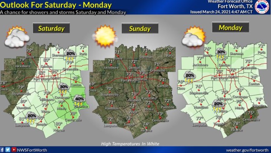
Wednesday through Monday.
Low thunderstorm chances return to the forecast east of I-35 on Saturday afternoon and night and across much of the region, Sunday
night and Monday.
SPOTTER INFORMATION STATEMENT
The National Weather Service could activate spotters late this afternoon and tonight for much of North and Central Texas.
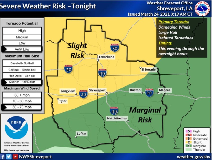
South-Central and Southwest Arkansas, North-Central and Northwest Louisiana, Southeast Oklahoma, East, and Northeast Texas.
Today and Tonight
Showers and thunderstorms will increase in coverage this evening. A few storms could become severe, with large hail and damaging
winds being the main threats. The highest chances for severe thunderstorms will occur across Southeast Oklahoma, Southern
Arkansas, Northeast Texas, and extreme Northwest Louisiana.
Thursday through Tuesday
The severe weather threat will continue into Thursday across the remainder of the ArkLaTex with the highest risk across North
Louisiana and Southern Arkansas. Large hail, damaging winds, and tornadoes will be possible through Thursday afternoon.
Thunderstorms will return to the region again Saturday into Sunday. The NWS isn’t expecting severe weather at this time.
SPOTTER INFORMATION STATEMENT
Activation of emergency management personnel, amateur radio operators and storm spotters may be needed later tonight.