


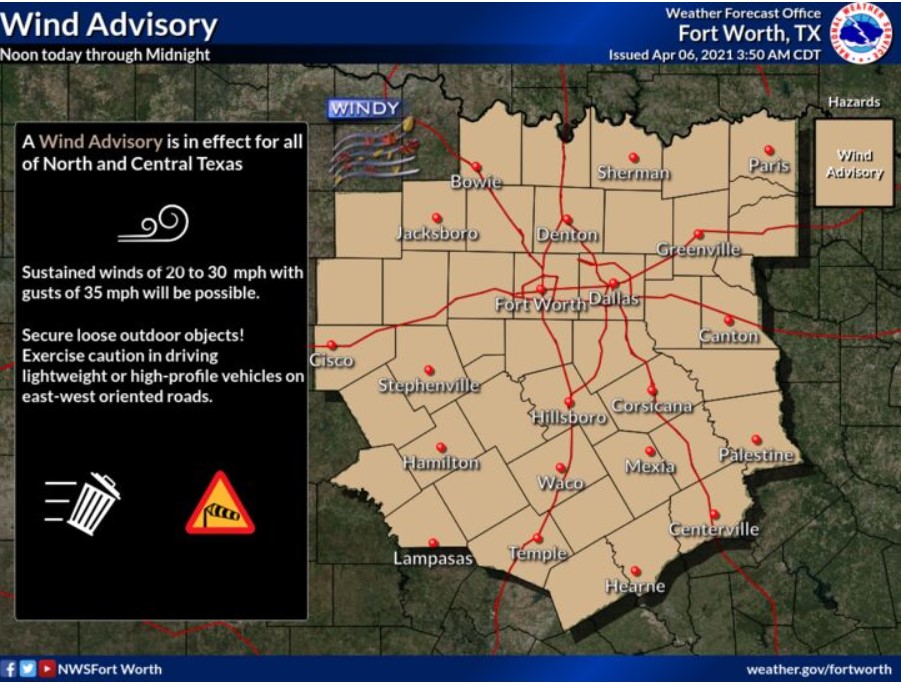
North and Central Texas
Wednesday through Monday.
Thunderstorm chances increase across East Texas on Wednesday. A solid or severe storm or two will be possible Wednesday afternoon,
primarily along and south of Interstate 30 and along and east of Interstate 45. Hail is the primary concern. Localized very gusty outflow winds are possible across eastern Central Texas.
Dry and breezy conditions will create an elevated grass fire threat Wednesday afternoon west of Highway 281 and again across western
Central Texas on Thursday afternoon.
Thunderstorm chances should increase Friday afternoon and evening, with the most significant coverage occurring east of Interstate 35. Though uncertainty remains high, there is the potential for strong to severe storms. It is too early to ascertain the exacting weather threat details, so check back for later forecast updates.
Low thunderstorm chances return late Sunday night and into Monday night. We anticipate no severe weather with this episode at this
time.
SPOTTER INFORMATION STATEMENT
We do not need spotter activation at this time.
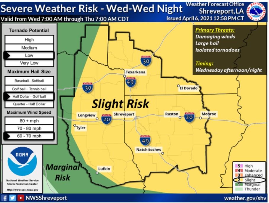
South Central and Southwest Arkansas, North Central and Northwest Louisiana, Southeast Oklahoma, East and Northeast Texas
Wednesday through Monday
Expect showers and thunderstorms to develop throughout the day Wednesday, intensifying by early afternoon over Southwest
Arkansas, Northwest Louisiana, and East Texas, along with and ahead of a cold front and associated upper-level storm system over the
Plains extending south into Oklahoma and North Texas.
These storms are expected to organize into a squall line and shift southeast across Southcentral Arkansas, North Louisiana, and possibly Deep East Texas during the afternoon and evening.
Given the extent of instability, wind shear, and forcing along and ahead of the front, some of these storms will be severe, with damaging
winds, large hail, isolated tornadoes, and locally heavy rainfall possible.
Additional scattered showers and thunderstorms will be possible across the region Thursday night near a warm front that will lift north, with thunderstorms becoming more numerous Friday afternoon and night ahead of a cold front and associated upper-level disturbance. Isolated strong to severe thunderstorms can not be ruled out over the region during this time, with the threat for locally heavy rainfall possible Friday afternoon and night.
SPOTTER INFORMATION STATEMENT
Activation of emergency management personnel, amateur radio operators, and storm spotters unneeded through tonight.