


North and Central Texas
Today and Tonight
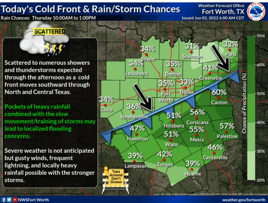
Expect numerous showers and thunderstorms scattered through the afternoon as a cold front moves southward through North and Central Texas. Pockets of heavy rainfall combined with the slow movement-training of storms may lead to localized flooding concerns. In addition, you can anticipate gusty winds, frequent lightning, and locally heavy rainfall possible with the stronger storms.
Friday through Wednesday
Intermittent thunderstorm chances will continue into the upcoming weekend, but the NWS does not expect additional severe weather.
SPOTTER INFORMATION STATEMENT
Do not expect spotter activation at this time.
South Central and Southwest Arkansas, North Central and Northwest Louisiana, Southeast Oklahoma, and East and Northeast Texas
Today and Tonight
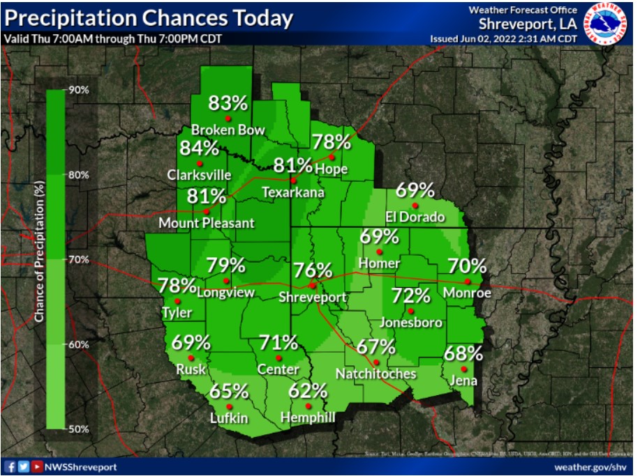
Showers and thunderstorms will accompany an upper-level disturbance and a cold front today, overspreading the Four State region from the north and west. These storms will likely produce periods of locally heavy downpours, strong wind gusts, and possibly small hail. There will be a greater risk of damaging wind gusts later today, mainly across portions of Deep East Texas into most northern Louisiana and South-Central Arkansas. Storm coverage and intensity should diminish this evening into the overnight hours.
Friday through Wednesday
Scattered to numerous showers and thunderstorms will be possible again this weekend, especially Saturday night into Sunday, with the
arrival of yet another upper-level disturbance. Again, locally heavy downpours and strong winds will be possible Saturday night into Sunday.
SPOTTER INFORMATION STATEMENT
Activation of emergency management personnel, amateur radio operators and storm spotters may be needed today or tonight.