


North and Central Texas.
Tonight
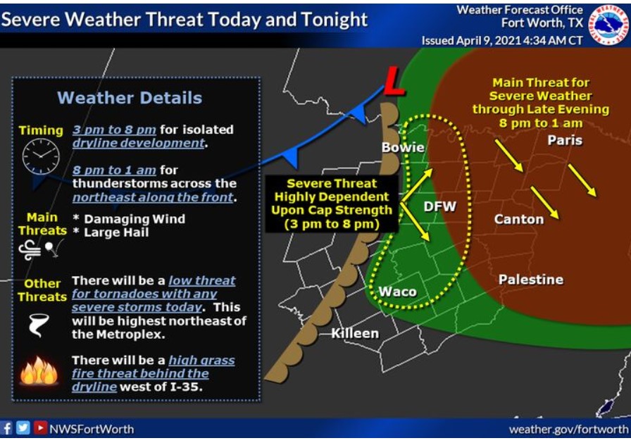
There is a threat for severe weather today, mainly along and east of I-35. A dryline will approach I-35 by mid-afternoon. If any storms
can develop along the dryline, they will be severe with large hail and damaging winds. An isolated tornado will also be possible.
Later tonight, a line of severe thunderstorms along a cold front will move out of southeast Oklahoma and into parts of North Texas. Areas
northeast of the Metroplex from Greenville to Paris and across our eastern areas from Canton to Athens may see some of these storms
tonight. Damaging winds would be the main threat during this time.
This afternoon, there will be a high grass fire threat behind a dryline west of I-35, where temperatures climb into the mid-90s with
gusty winds and low humidity.
Saturday through Thursday
Breezy and dry conditions Saturday and Sunday will lead to elevated
fire weather concerns west of I-35.
Storm chances return Monday night and linger through much of the
week. Non-severe storms will occasionally impact the region, with
lightning being the main threat.
SPOTTER INFORMATION STATEMENT
Spotter activation is likely this afternoon east of I-35.
South-Central and Southwest Arkansas, North-Central and Northwest Louisiana, Southeast Oklahoma, East, and Northeast Texas
Tonight
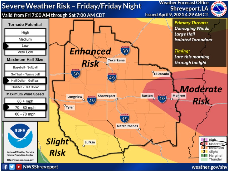
Expect scattered showers and thunderstorms to develop late this morning into the afternoon across portions of Northeast
Texas, Southeast Oklahoma, Southwest Arkansas, and North Louisiana, near and north of a warm front that will lift north
into Southeast Oklahoma and Southwest Arkansas. Some of these storms may be severe, with damaging winds, large hail, and
isolated tornadoes possible. Additional shower and thunderstorm development are possible this evening over portions of East Texas
and North Louisiana, ahead of a severe squall line that will develop over Eastern Oklahoma and quickly shift southeast across
the region from mid-evening through the overnight hours. The severe weather threat will become more pronounced with this squall
line, with damaging winds, large hail, isolated tornadoes, and locally heavy rainfall possible. These storms will diminish from northwest to southeast late tonight.
Saturday through Thursday
Scattered showers and isolated thunderstorms will be possible across the region Tuesday through Thursday. However, expect no hazardous weather.
SPOTTER INFORMATION STATEMENT
Expect the activation of emergency management personnel, amateur radio operators, and storm spotters late this morning through tonight across the region.