


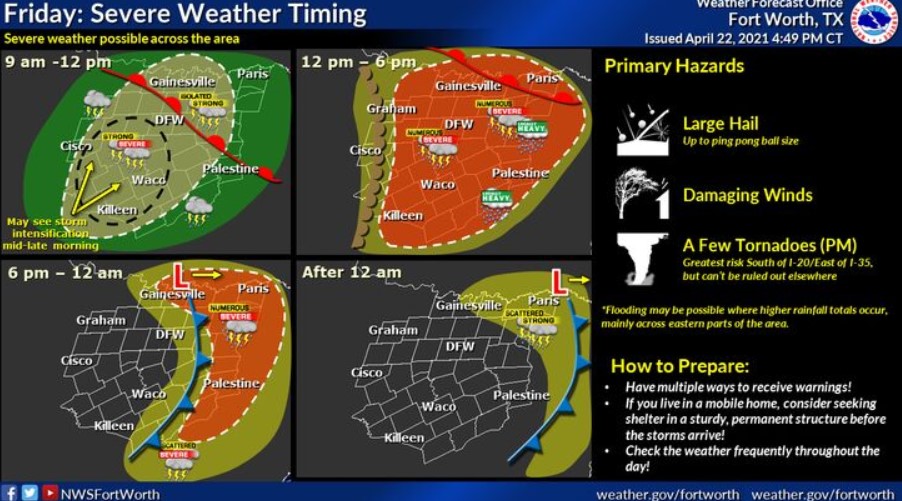
North and Central Texas
Today and Tonight
Expect thunderstorms to develop and increase in coverage and intensity this afternoon. Some storms will become severe, with large hail, damaging winds, and a few tornadoes all possible. The best storm chances will be along and east of Interstate 35, but severe storms are still possible west of I-35. Storms will come to an end from west to east late this evening and overnight.
Saturday through Thursday
Storm chances are expected late Tuesday through early Thursday, and some strong to severe storms will be possible.
SPOTTER INFORMATION STATEMENT
Spotter activation is likely this afternoon and evening, mainly along and east of the Interstate 35 corridor.
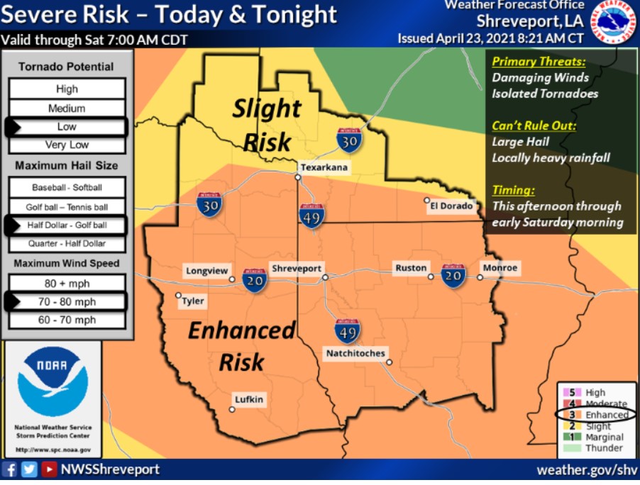
South-Central and Southwest Arkansas, North-Central and Northwest Louisiana, Southeast Oklahoma, and East and Northeast Texas
Today and Tonight
Showers and thunderstorms will become widespread this afternoon. Some storms could be severe from this afternoon through the very early hours of Saturday morning. Tornadoes, damaging winds, and large hail will be possible. Locally heavy rainfall could also lead to flash flooding. The severe weather threat should end a few hours after midnight, with thunderstorms gradually diminishing through daybreak Saturday morning.
Saturday through Thursday
Strong to severe thunderstorms will be possible again Tuesday afternoon through late Wednesday.
SPOTTER INFORMATION STATEMENT
Activation of emergency management personnel, amateur radio operators, and storm spotters will be needed from this afternoon through tonight. Please relay any information about observed severe weather to the NWS while following all local, state, and CDC guidelines.