


North and Central Texas
Today and Tonight
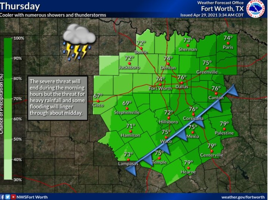
Widespread showers and thunderstorms will continue through much of the morning across North and Central Texas. A few thunderstorms may be severe, with tornadoes, large hail, and damaging winds possible. Additionally, heavy rainfall may lead to flash flooding in some areas. Thunderstorm chances will decrease during the afternoon but may continue across parts of Central Texas through the evening.
Friday through Wednesday
Additional thunderstorms are likely on Saturday and again on Monday. The severe weather potential remains uncertain at this time.
SPOTTER INFORMATION STATEMENT
There could be limited spotter activation east of Interstate 35 through the morning hours.
Southwest Arkansas, Southeast Oklahoma, and Northeast Texas
Today and Tonight
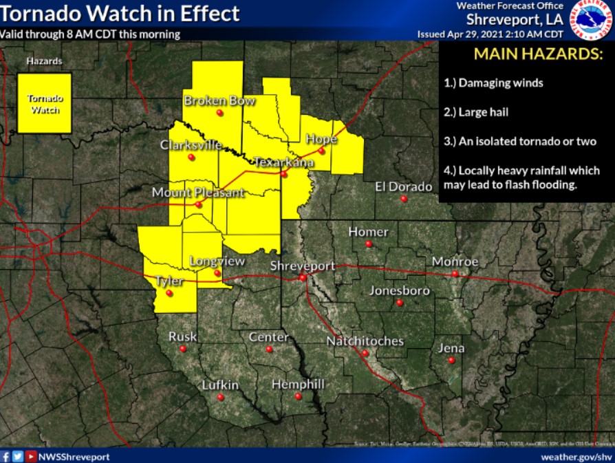
Showers and isolated thunderstorms will continue today near a slow-moving cool front. Some severe weather will be possible with these storms, damaging winds, large hail, and possibly a tornado or two. Also, these exact locations could see locally heavy rainfall. Some flash flooding may occur, as rainfall totals of 2 to 4 inches, with isolated higher amounts, will be possible.
Friday through Wednesday
Some slightly cooler and drier air will filter into the area in the wake of the front on Friday, but rain chances will continue through the weekend as an upper-level trough moves across the region. Dry weather will return on Monday, but rain chances return by the middle of next week, as another cool front moves into the area.
SPOTTER INFORMATION STATEMENT
The NWS could activate emergency management personnel, amateur radio operators, and storm spotters through Thursday. Please relay any information about observed severe weather to the NWS while following all local, state, and CDC guidelines.