


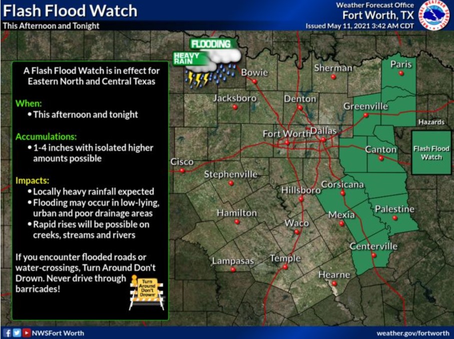
North and Central Texas
Today and Tonight
Scattered to widespread thunderstorms are expected late this morning and afternoon, primarily east of I-35. While the severe weather
threat is low, periods of heavy rain may lead to isolated flash flooding across Eastern North and Central Texas. Creeks, streams, and
mainstem rivers across this area may also experience minor flooding, rapid rises, and swift-moving water. Thunderstorm chances should
linger over Central Texas through the night.
Wednesday through Monday
Isolated thunderstorms return to the forecast late Saturday through Monday. At this time, details regarding severe weather’s potential remain unclear, and computer models suggest checking back later this week for updates to the forecast.
SPOTTER INFORMATION STATEMENT
The NWS does not expect spotter activation at this time, but timely reports of flooding are appreciated.
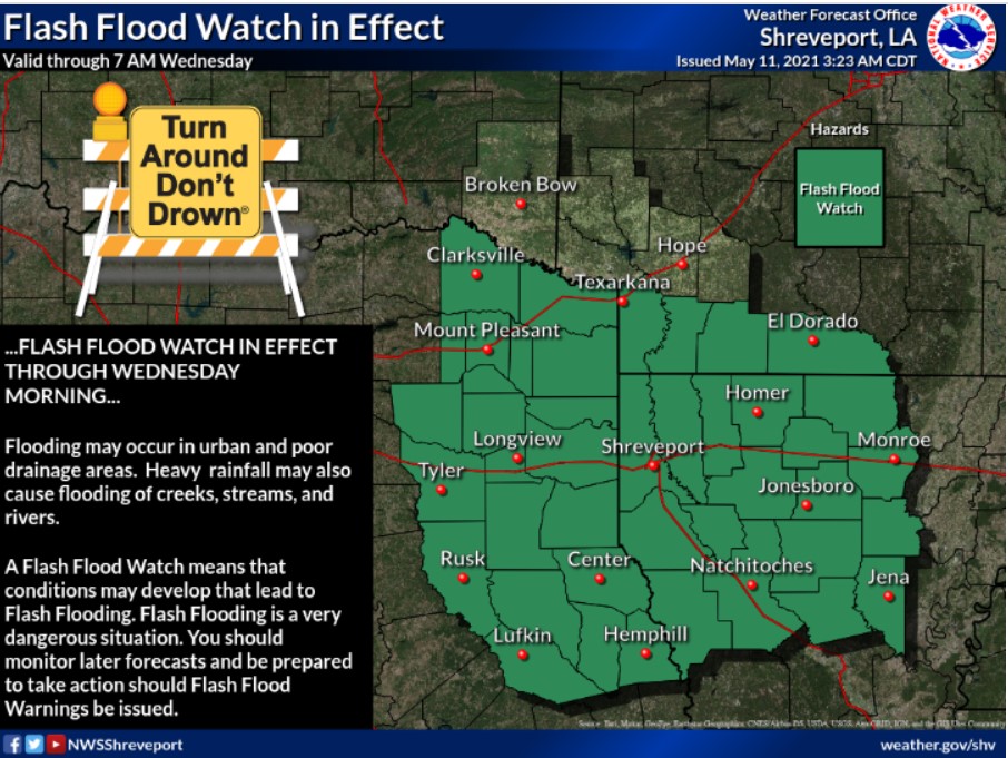
South Central and Southwest Arkansas, North Centra and Northwest Lousiana, East and Northeast Texas
Today and Tonight
Periods of moderate to heavy rainfall will be possible today and tonight, resulting in some localized flash flooding. A flash flood watch has been issued for these areas, as soils are already rather saturated from previous rainfall. A few of these storms may be vital to severe as well. Damaging winds and hail would be the primary threats to this activity.
Wednesday through Monday
Dry conditions settle in by Wednesday afternoon and will remain into the weekend. Shower and thunderstorm chances return by Sunday
night, with moderate rain passable again into Monday.
SPOTTER INFORMATION STATEMENT
Activation of emergency management personnel, amateur radio operators, and storm spotters will be needed this afternoon and
evening.