


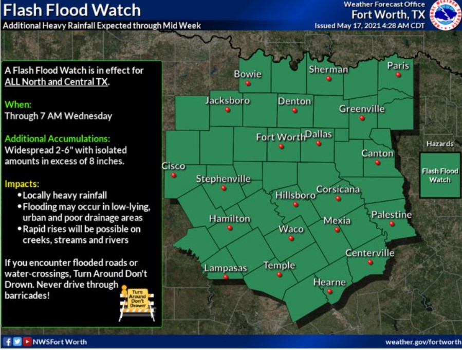
North and Central Texas
Today and Tonight.
Expect widespread thunderstorms today, some of which could be severe. Additionally, heavy rainfall will likely result in flash flooding.
Wednesday through Monday
Thunderstorm chances will continue through the weekend. Additional rounds of heavy rainfall may cause further flooding issues and significant rises on area rivers through late this week. Additionally, a few strong to severe thunderstorms may be possible.
SPOTTER INFORMATION STATEMENT
NWS does not expect activation of spotters.
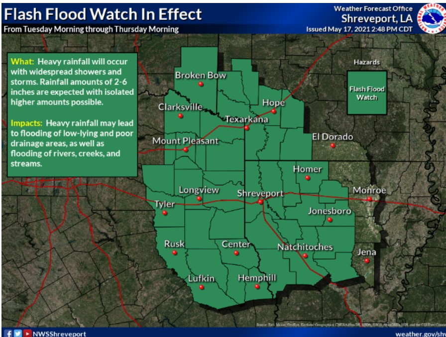
South Central and Southwest Arkansas, North Central and Northwest Louisiana, Southeast Oklahoma, East, and Northeast Texas
Today and Tonight
Showers and thunderstorms will increase later today across the region, ahead of an upper-level disturbance that will eject northeast into the area. Pockets of locally heavy rainfall and gusty winds will be possible in the stronger storms, with a more organized potential for strong to severe thunderstorms and locally heavy rain developing late this afternoon through tonight across East Texas, Southeast Oklahoma, and portions of Southwest Arkansas. Damaging winds and large hail will be the primary threats late this afternoon through the evening before transitioning to heavy rainfall and flash flooding, especially for the evening and overnight hours. A Flash Flood Watch is in effect through Thursday morning for all of East Texas, McCurtain County, Oklahoma, Southwest Arkansas, and North Louisiana.
Wednesday through Monday
Showers and thunderstorms will continue areawide Wednesday and Thursday, with the threat of locally heavy rainfall and flash flooding persisting. Additional rainfall amounts of two to five inches are expected, with isolated higher amounts over six inches possible, especially over East Texas. Isolated strong thunderstorms will be possible through Friday as well, with locally gusty winds the primary threat. The showers and thunderstorms should be more scattered Friday before diminishing on Saturday as an upper-level ridge of high pressure build west into the region.
SPOTTER INFORMATION STATEMENT
The NWS will need the activation of emergency management personnel, amateur radio operators, and storm spotters this afternoon and tonight for the potential of severe thunderstorms and flash flooding.