


North and Central Texas
Today and Tonight
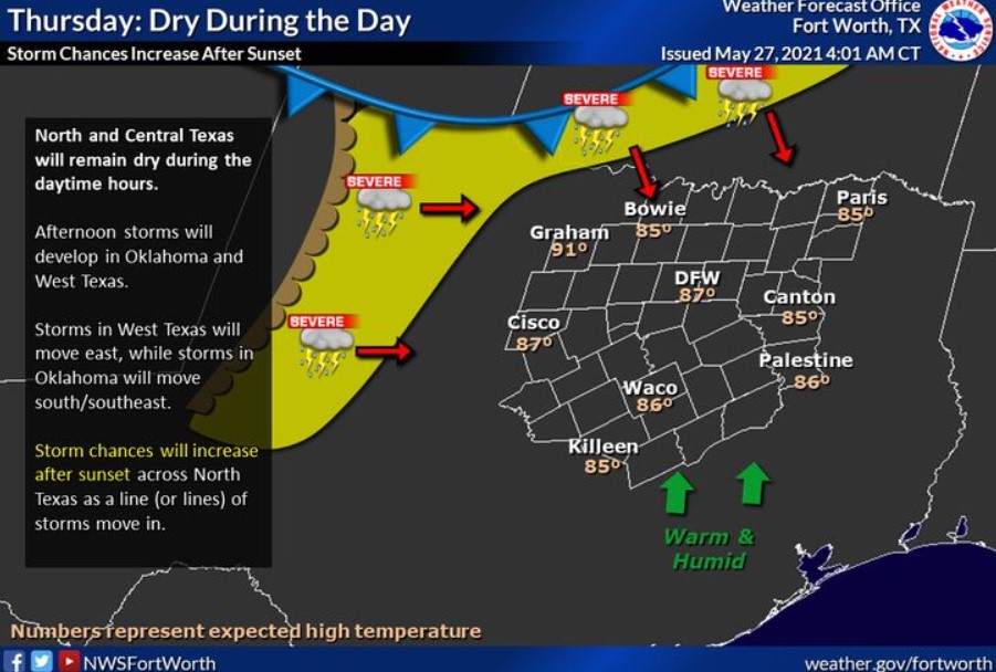
Following some dry time during the day, a complex of storms is expected to move into North Texas later tonight. These storms could pose a threat for damaging wind gusts and flooding due to heavy rainfall.
Friday through Wednesday
Thunderstorms remain possible on Friday and early Saturday before a break from storm chances on Sunday. Additional thunderstorms are possible during the first half of next week. Any storms during this time could contain strong wind gusts and heavy rainfall supportive of flooding.
SPOTTER INFORMATION STATEMENT
The NWS does not expect spotter activation at this time.
 South Central and Southwest Arkansas, North Central and Northwest Louisiana, Southeast Oklahoma, East and Northeast Texas
Today and Tonight
By tonight, locally heavy rainfall from widespread showers and thunderstorms can produce isolated flash flooding, especially along the U.S. Highway 82 corridor in northeast Texas and southwest Arkansas.
Friday through Wednesday
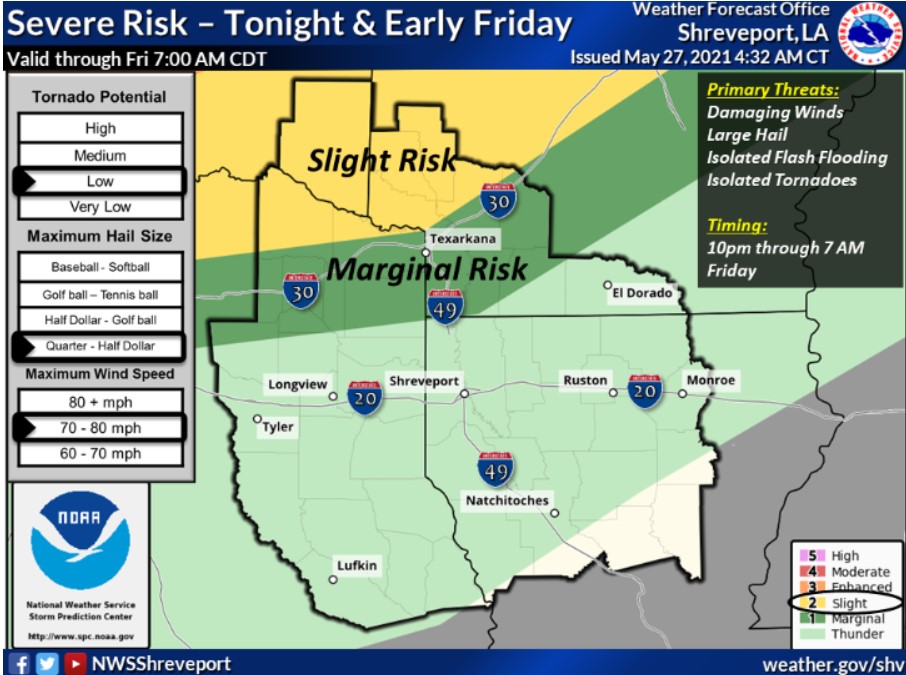
Showers and thunderstorms will return across the region Thursday night and into Friday morning. A squall line sets off this activity, and some of these storms can be strong to severe, mainly north of I-20. Damaging winds will be the primary threat.
SPOTTER INFORMATION STATEMENT
The NWS could activate emergency management personnel, amateur radio operators, and storm spotters Thursday night. Please relay any information about observed severe weather to the NWS while following all local, state, and CDC guidelines.