


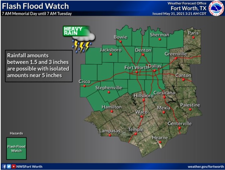
North and Central Texas
Today and Tonight
A chance for thunderstorms mainly south of I-20 today. Additional rainfall may result in some localized flooding. The NWS does not expect severe thunderstorms.
Wednesday through Monday.
Thunderstorm chances will continue the rest of the week into early next week. The NWS does not expect severe thunderstorms, but locally heavy rainfall may result in additional flooding.
SPOTTER INFORMATION STATEMENT
The NWS does not expect spotter activation at this time.
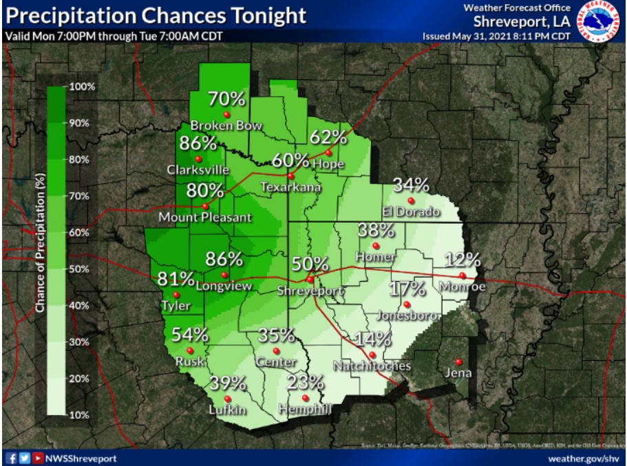
South Central and Southwest Arkansas, North Central and Northwest Louisiana, Southeast Oklahoma, East and Northeast Texas
Today and Tonight
Showers and thunderstorms will expand in coverage across the region today. Locally heavy rainfall and gusty winds may be possible with some storms.
Wednesday through Monday
Showers and thunderstorms will continue through the remainder of the workweek. Some heavy rain concerns will persist into the weekend, with the risk of severe storms generally remaining low most of these days.
SPOTTER INFORMATION STATEMENT
The NWS does not expect the activation of emergency management personnel, amateur radio operators, and storm spotters.