


 North and Central Texas
Today and Tonight
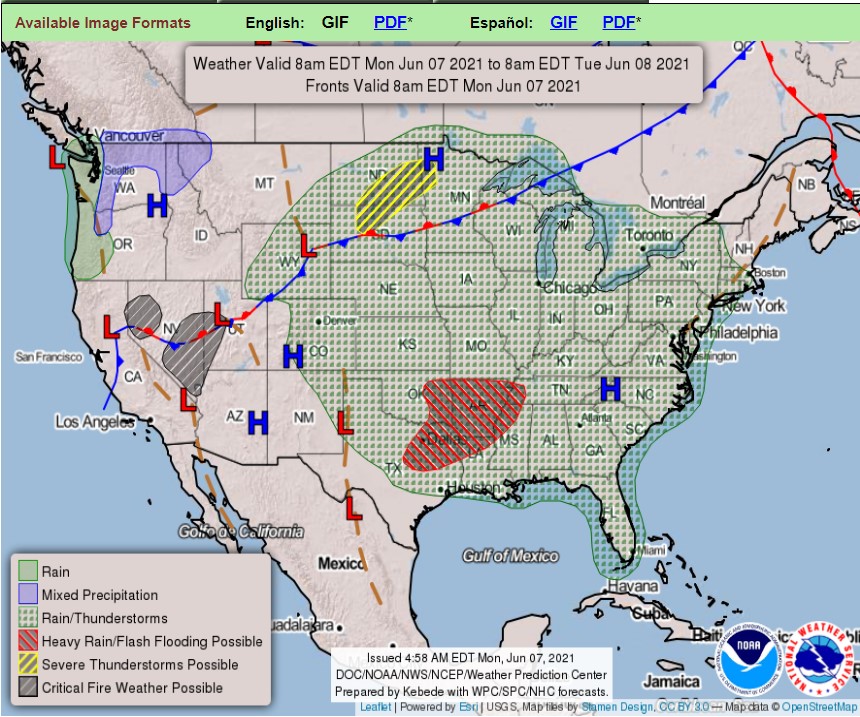
Thunderstorms will move into the Big Country early this morning and may pose a strong to damaging wind threat, mainly west of the U.S. Highway 281 corridor. The potential for flash flooding, especially along the I-20 corridor, will exist late this morning and early afternoon.
Tuesday through Sunday
Widely scattered thunderstorms remain possible east of a Sherman, Dallas, to Cameron line on Tuesday. Don’t expect severe weather. However, a few stronger storms with gusty winds and frequent lightning are possible. Very localized heavy rainfall may result in renewed instances of flooding. You should not expect flooding to be widespread.
Isolated thunderstorms may return to the parts of the area by next weekend.
SPOTTER INFORMATION STATEMENT
The NWS does not expect Spotter activation at this time. However, reports of heavy rainfall and flooding to the National Weather Service is
appreciated.
 South Central and Southwest Arkansas, North Central and Northwest Louisiana, Southeast Oklahoma, East and Northeast Texas
Today and Tonight
Showers and thunderstorms will be possible across the entire region today, with localized heavy rain possible. It could lead to isolated flash flooding in low-lying and poor drainage areas and locations that have seen significant rainfall in the past week. In addition to the heavy rain, strong gusty winds will be possible with any organized cluster of storms.
Tuesday through Sunday
Widespread showers and thunderstorms will continue on Tuesday, which may lead to additional localized flash flooding concerns. You can’t rule out solid gusty winds, primarily if storms organize into clusters. Much drier conditions are expected for the remainder of the week as upper ridging builds into the region. Widespread rain chances are possible by next weekend.
SPOTTER INFORMATION STATEMENT
The NWS does not expect the activation of emergency management personnel, amateur radio operators, and storm spotters.