


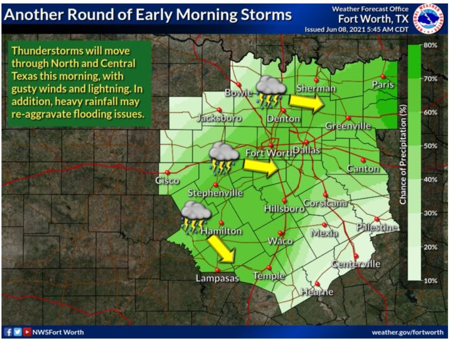
North and Central Texas
Today and Tonight
A thunderstorm complex will impact the region again this morning. The NWS does not anticipate severe weather, but heavy rainfall may reaggravate flooding issues. Lightning will also accompany the activity. Other thunderstorms will be possible today, particularly across East and Northeast Texas. Heavy rainfall and lightning will be the primary concerns.
Wednesday through Monday
Low thunderstorm chances may return during the upcoming weekend and into early next week.
SPOTTER INFORMATION STATEMENT
The NWS does not expect spotter activation at this time.
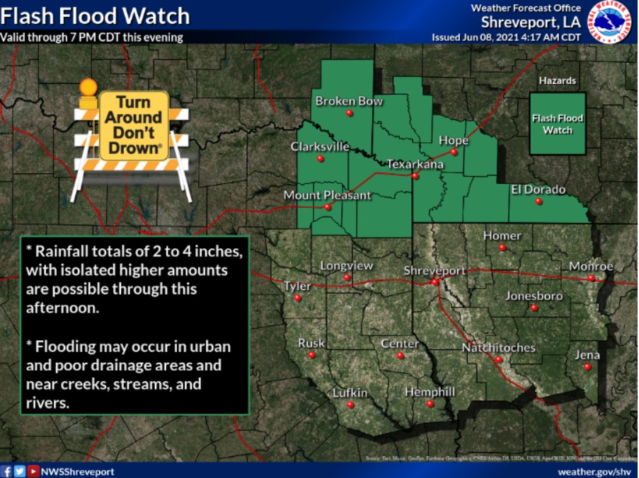
South Central and Southwest Arkansas, Southeast Oklahoma, and Northeast Texas
Today and Tonight
Widespread showers and thunderstorms will continue today. Locally
heavy rainfall will be possible with these storms, leading to additional flooding across the region. A Flash Flood Watch remains in effect through 7:00 pm if storms organize in clusters.
Wednesday through Monday
You can expect drier conditions for the remainder of the week as upper ridging builds into the region from the west. The ridge
will start to retrograde by the weekend, and widespread rain chances will return.
SPOTTER INFORMATION STATEMENT
Activation of emergency management personnel, amateur radio operators, and storm spotters will be needed this afternoon.