


This Hazardous Weather Outlook is for North and Central Texas.
Today and Tonight.
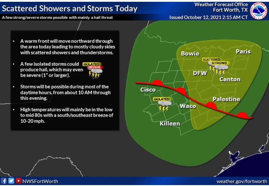
There is a chance of storms today across much of North and Central Texas. A few strong to severe storms will be possible, with hail being the primary threat.
Wednesday through Monday
Storm chances return Wednesday and continue through the end of the
week. Heavy rain may cause flooding in some areas Wednesday and Thursday.
SPOTTER INFORMATION STATEMENT
The NWS could request limited spotter activation later this afternoon.
This Hazardous Weather Outlook is for South-Central and Southwest Arkansas, North-Central and Northwest Louisiana, Southeast Oklahoma, East, and Northeast Texas.
Today and Tonight
Rain chances will return across the region today as yesterday`s cool front returns northward as a warm front. This afternoon, we can`t rule out an isolated strong to severe storm across SE Oklahoma and portions of East Texas, north of the Interstate 30 corridor. Large hail and damaging winds are the primary threat.
Wednesday through Monday
Rain chances will remain in the forecast through the remainder of the workweek as pacific moisture, along with the remnants of Tropical Cyclone Pamela, move across the region in the southwest flow ahead of another cool front expected to move through the area on Friday. On Wednesday and Thursday, the best rain chances will remain northwest of a line from Lufkin to Texarkana, Arkansas, with heavy rainfall and some isolated flash flooding possible in these areas. We expect no additional hazards at this time.
SPOTTER INFORMATION STATEMENT
The NWS will not need the activation of emergency management personnel, amateur radio operators, and storm spotters through tonight.