


North and Central Texas
Today and Tonight
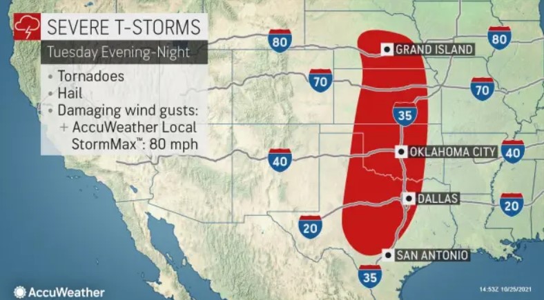
Expect a line of thunderstorms to move across North and Central Texas tonight with severe weather likely. The highest potential for thunderstorms is west of a line from Sherman to Corsicana, Waco, and Temple. Damaging winds will be the primary hazard. Larger hail
and a few tornadoes will be possible with any discrete storms within or just ahead of the line.
Timeline
Wednesday through Monday
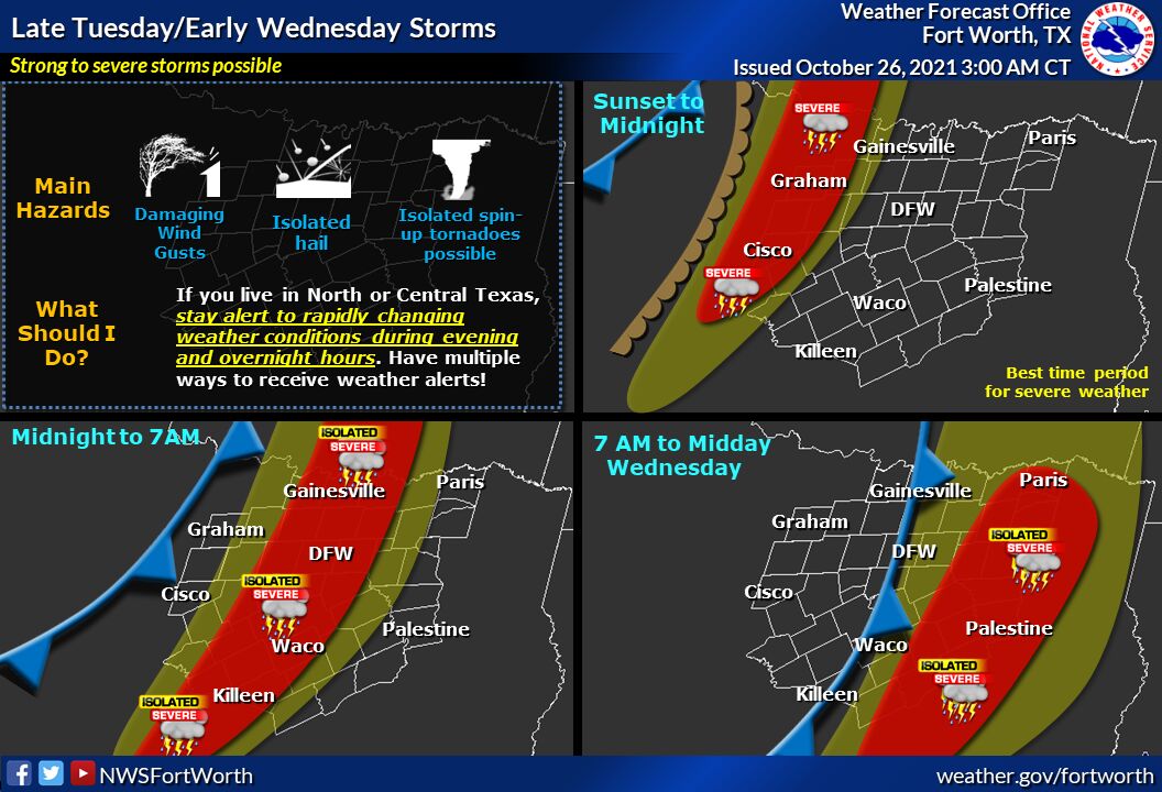
The threat for severe weather continues Wednesday morning along and east of I-35, as the cold front and associated line of intense and
severe storms continues moving quickly into East Texas and toward the Louisiana border. The greatest threat for severe weather will be
across eastern Central Texas. Thunderstorms should exit the area by midday Wednesday.
Very windy conditions will occur behind the cold front late Wednesday and continue through the end of the week. Northwest winds 25 to 30
mph with gusts to nearly 40 at times will be possible and cause dangerous crosswinds on regional highways and interstates. Open waters on area lakes will be very choppy as well.
SPOTTER INFORMATION STATEMENT
Some spotter activation may be requested, especially along and west of a line from Sherman, to Corsicana, to Waco and Temple where more
widespread severe weather is possible.
South-Central and Southwest Arkansas, North-Central and Northwest Louisiana, Southeast Oklahoma, East, and Northeast Texas
Today and Tonight
The NWS does not expect hazardous weather.
Wednesday through Monday
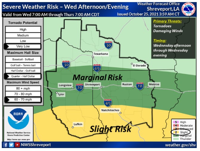
Another round of strong to severe thunderstorms will be possible areawide Wednesday, as a strong cold front moves across the area. At this time, it appears that all modes of severe weather will be possible with these storms before the threat diminishes on Wednesday night as the cold front departs to the east.
SPOTTER INFORMATION STATEMENT
the activation of emergency management personnel, amateur radio operators, and storm spotters could happen throughout the day
Wednesday.